
Browse hiking guides: family walks, islands, reservoirs and mountain views
Start with the scenery and time you want: Pak Tam Chung for short and family walks, Sharp Island for the coast and tombolo, or East Dam for the reservoir and rock columns. Po Pin Chau and the full MacLehose Section 1 need separate experience and return planning.
Compare six starting choices below, followed by 31 route entries. This is our selection, not a fixed count of every official Sai Kung trail. Distinguish walking, sightseeing and transport time.
Choose a Sai Kung hike: six starting options
Choose a type of outing, then open the detailed guide for access and preparation. None of the times below is a complete round trip from Sai Kung town.
| Your outing | Route, time and access |
|---|---|
| First walk / family | Pak Tam Chung Family Walk 1.4 km · 45-minute reference · one star. Start at Pak Tam Chung and exit towards Tsak Yue Wu bus stop; allow children extra breaks. |
| Short walk / shade | Pak Tam Chung Tree Walk 0.6 km · 30-minute reference · one star. Add about five minutes from the bus stop to the entrance. Shade does not remove heat risk. |
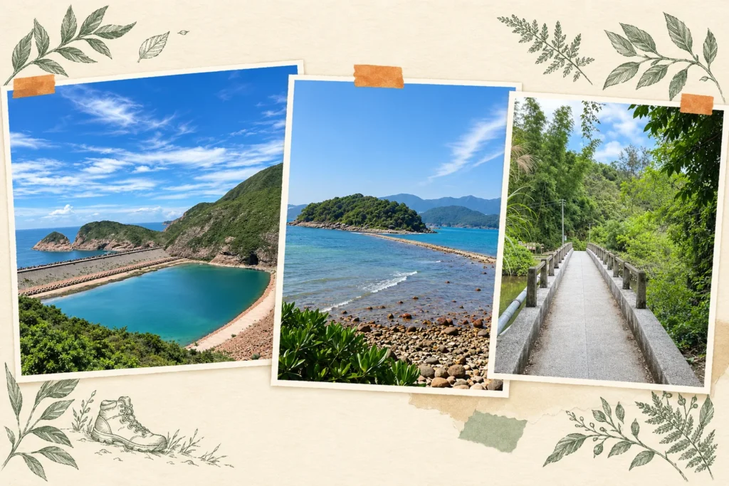
| Coast / tombolo | Sharp Island Geo Trail 1.4 km return; the Geopark suggests two hours for a visit. Add ferries and check tides and the return boat. |
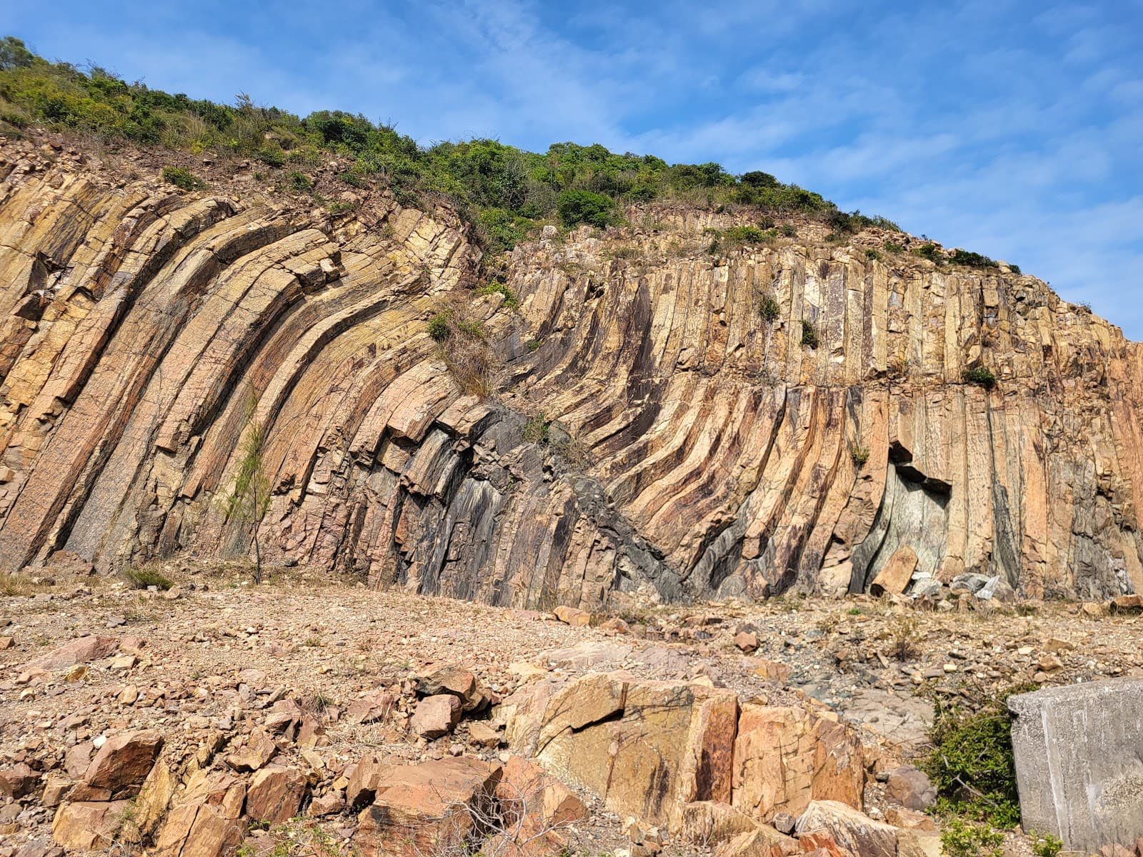
| Reservoir / rock columns | High Island East Dam section 2.8 km · two-hour reference · one star. Arrange an operating 9A or taxi to the dam. This is distinct from Po Pin Chau. |
| Hill trail / viewpoint | Po Pin Chau section 2 km return · two-hour reference · three stars. For experienced hikers; check booking requirements for your date and time. |
| Long walk / reservoir to beach | MacLehose Trail Section 1 10.6 km · 3 hr 15 min reference · three stars. Long Ke still requires a walk out to transport; budget for it separately. |
Use the trail access and return-transport guide before choosing a start. The full 31-route comparison follows below.
What if I only have three hours?
Decide whether three hours means walking time or the whole trip. For three hours from Sai Kung town and back, research a short Pak Tam Chung walk and check actual connections and your group’s pace. If it is a walking budget, East Dam still needs added transport time. Full MacLehose Section 1 already has a 3 hr 15 min reference before the onward exit.
Start with three questions
1. How much time do you have?
A published walking time is not your complete door-to-door itinerary: add access walks, rests, photos, navigation and transport waits, with a contingency suited to the route and group.
2. What do your experience and fitness support?
The overall scale runs from one star to five. Look beyond that summary to total ascent and trail surface, alongside distance, exposure and conditions. For an explanation, see the Hong Kong hiking difficulty guide.
3. How much sun exposure can you manage?
Enjoy Hiking also shows shade. It matters for heat and comfort, but shade alone cannot make a hot-weather hike safe. Open coastal viewpoints can involve prolonged exposure, so consider the forecast, timing, water and everyone's condition.
A 31-route comparison
The figures below reproduce the guide's route compilation for comparison; ascent and surface are one-to-five ratings, not metres. A dash means shade was not recorded in this table. Check current access separately.
| Route | Length | Reference time | Overall | Ascent score | Surface score | Shade |
|---|---|---|---|---|---|---|
| Tai Tan Tree Walk | 0.2 km | 0.5 h | 1 star | 1 | 1 | High |
| Wong Shek Tree Walk | 0.4 km | 0.5 h | 1 star | 1 | 2 | High |
| Kei Ling Ha Tree Walk | 0.6 km | 0.5 h | 1 star | 1 | 2 | High |
| Pak Tam Chung Tree Walk | 0.6 km | 0.5 h | 1 star | 1 | 1 | High |
| Pak Tam Chung Nature Trail | 0.9 km | 0.5 h | 1 star | 1 | 1 | Medium |
| Tsiu Hang Nature Trail | 0.9 km | 0.5 h | 1 star | 1 | 2 | High |
| Clear Water Bay Tree Walk | 0.95 km | 0.75 h | 1 star | 1 | 2 | Medium |
| Lai Chi Chong Geosite | 1 km | 0.5 h | 1 star | 1 | 2 | Low |
| Pak Tam Chung Family Walk | 1.4 km | 0.75 h | 1 star | 1 | 1 | High |
| Sharp Island Geo Trail | 1.4 km | 0.75 h | 1 star | 1 | 2 | Low |
| Sharp Island Country Trail | 1.9 km | 1 h | 1 star | 1 | 1 | Medium |
| Wong Shek Family Walk | 1.9 km | 1.25 h | 1 star | 1 | 1 | Low |
| Pak Tam Country Trail | 2 km | 0.75 h | 1 star | 1 | 2 | Medium |
| High Island Geo Trail: East Dam Section | 2.8 km | 2 h | 1 star | 1 | 1 | — |
| Sheung Yiu Family Walk | 1.8 km | 1.25 h | 2 stars | 1 | 2 | Medium |
| High Island Geo Trail: Biu Tsim Kok Section | 1.8 km | 1.5 h | 2 stars | 2 | 2 | Low |
| Lung Ha Wan Country Trail | 2.5 km | 1.5 h | 2 stars | 2 | 3 | Low |
| Sheung Yiu Country Trail | 3.2 km | 1.25 h | 2 stars | 1 | 2 | Low |
| Tai Tan Country Trail—partial-closure notice | 7.2 km | 3 h | 2 stars | 2 | 2 | Medium |
| High Island Geo Trail: Po Pin Chau Section—check reservation dates | 2 km | 2 h | 3 stars | 3 | 4 | — |
| Cheung Sheung Country Trail | 4.5 km | 2.25 h | 3 stars | 3 | 2 | Medium |
| Luk Wu Country Trail | 5.4 km | 2.5 h | 3 stars | 3 | 3 | Low |
| High Junk Peak Country Trail | 6.5 km | 3 h | 3 stars | 3 | 3 | Medium |
| MacLehose Trail Section 1 (Pak Tam Chung–Long Ke) | 10.6 km | 3.25 h | 3 stars | 3 | 2 | Low |
| Pak Tam Chung–Biu Tsim Kok Hiking Trail | 11.1 km | 3.75 h | 3 stars | 4 | 2 | Low |
| Wilson Trail Section 3: Lam Tin–Tseng Lan Shue | 9.3 km | 3.5 h | 4 stars | 4 | 3 | Low |
| Shui Long Wo–Tai Shui Tseng | 8.8 km | 5 h | 4 stars | 4 | 4 | Medium |
| MacLehose Trail Section 3: Pak Tam Au–Kei Ling Ha | 10.2 km | 4 h | 4 stars | 5 | 4 | Medium |
| Tai Long Wan Hiking Trail | 11.4 km | 4 h | 4 stars | 4 | 4 | Medium |
| MacLehose Trail Section 4: Kei Ling Ha–Tate's Cairn | 12.7 km | 5.25 h | 5 stars | 5 | 4 | Medium |
| MacLehose Trail Section 2: Long Ke–Pak Tam Au | 13.5 km | 5.25 h | 5 stars | 5 | 4 | Low |
Emphasised names identify routes featured elsewhere in this guide series; emphasis is not a safety or accessibility rating.
Compare by reference walking time
Up to one hour
The compilation has 12 entries in this range, all rated one star. Several are around Pak Tam Chung and may suit families with children when the route, access, weather and each child's ability are appropriate.
Six entries have high shade: Tai Tan, Wong Shek, Kei Ling Ha and Pak Tam Chung tree walks, Tsiu Hang Nature Trail and Pak Tam Chung Family Walk. They may reduce exposure, but are not automatically safe summer choices.Pak Tam Chung Family Walk is one compact option: 1.4 km, a 45-minute reference time, high shade and one-point ascent and surface scores. Check the current route and transport before choosing it.
Around one to two hours
Sharp Island Country Trail (1.9 km, 1 hour), Wong Shek Family Walk (1.9 km, 1.25 hours), Sheung Yiu Family Walk (1.8 km, 1.25 hours), Sheung Yiu Country Trail (3.2 km, 1.25 hours), Biu Tsim Kok (1.8 km, 1.5 hours) and Lung Ha Wan (2.5 km, 1.5 hours) illustrate the range.
⚠️ Lung Ha Wan has a three-point surface score and low shade despite its short length. Evaluate the steps and exposure, not just the kilometres.
Around two to three hours
The East Dam geo-trail section (2.8 km, 2 hours, one star), Po Pin Chau (2 km, 2 hours, three stars), Cheung Sheung (4.5 km, 2.25 hours, three stars) and Luk Wu Country Trail (5.4 km, 2.5 hours, three stars) have quite different demands.
A similar time does not mean a similar effort. Po Pin Chau has a four-point surface score; check the official reservation requirement for your date and time before planning a visit.
Three hours or more
Examples include Tai Tan (7.2 km, 3 hours; check its partial closure), High Junk Peak Country Trail (6.5 km, 3 hours), MacLehose Section 1 (10.6 km, 3.25 hours), Pak Tam Chung–Biu Tsim Kok (11.1 km, 3.75 hours), Tai Long Wan (11.4 km, 4 hours), MacLehose Section 3 (10.2 km, 4 hours), Shui Long Wo–Tai Shui Tseng (8.8 km, 5 hours), and MacLehose Sections 2 and 4 (5.25 hours each).
These can occupy much of the day once access and breaks are added. Work backwards from daylight and return transport rather than assuming a universal five- or six-hour total. See the Sai Kung hiking transport guide.
Compare by overall difficulty
One star: 14 entries
The compilation has many lower-rated options, particularly tree and nature walks. Do not infer a rating from the name alone: Sheung Yiu Family Walk in this table is two stars.
One-star routes still differ. Sharp Island Geo Trail and Lai Chi Chong have low shade; the East Dam section has a two-hour reference time despite its modest distance. Allow time for the actual visit and transport.
Two stars: five entries
Sheung Yiu Family Walk, Biu Tsim Kok, Lung Ha Wan, Sheung Yiu Country Trail and Tai Tan Country Trail.
Tai Tan is longer with lower surface and ascent scores than Lung Ha Wan, but is not simply a flat stroll. Its current partial-closure notice must be checked; the rating does not override a closure.
Three stars: six entries
Po Pin Chau, Cheung Sheung, Luk Wu, High Junk Peak Country Trail, MacLehose Section 1 and Pak Tam Chung–Biu Tsim Kok.
These range from a 2 km geo-trail section to an 11.1 km hike. Po Pin Chau is short but has a higher surface score; MacLehose Section 1 includes substantial paved sections but still requires endurance and exposure planning.
⚠️ Pak Tam Chung–Biu Tsim Kok has an ascent score of four despite an overall three-star rating. Component scores explain demands that the overall label can hide.
Four stars: four entries
Wilson Section 3, Shui Long Wo–Tai Shui Tseng, MacLehose Section 3 and Tai Long Wan Hiking Trail.
Build experience gradually. MacLehose Section 3 has a five-point ascent score; do not assume the overall four-star rating means limited climbing or try to derive the overall score from length alone.
Five stars: two entries
MacLehose Sections 2 (13.5 km) and 4 (12.7 km) each have a 5.25-hour reference time, ascent score five and surface score four. Plan experience, water, daylight, navigation and realistic exit options accordingly.
Compare by shade
Shade is a separate exposure consideration. It does not eliminate heat risk, and a dash in the table should not be interpreted as shade being available.
| Shade | Recorded entries | Examples | Planning approach |
|---|---|---|---|
| High | 6 | Pak Tam Chung Family Walk, Pak Tam Chung/Tai Tan/Wong Shek/Kei Ling Ha tree walks and Tsiu Hang Nature Trail | Still check heat, humidity and warnings |
| Medium | 11 | Sharp Island Country Trail, Pak Tam, Tai Tan, Cheung Sheung, High Junk Peak Country Trail and Tai Long Wan | Allow for exposed sections and avoid excessive heat |
| Low | 12 | Sharp Island Geo Trail, Lai Chi Chong, Wong Shek Family Walk, Lung Ha Wan and MacLehose Sections 1 and 2 | Plan for sun, wind and sufficient water |
A common trade-off is that open views often come with less shade. This is not true of every metre of every route, but it is a useful reason to check exposure rather than choosing solely from a photograph. Two entries in the main table have no recorded shade value.
Popular destinations outside this compilation
Some familiar destinations are not among these 31 entries, including Sharp Peak, Tai Cham Koi, Tung Sam Kei and walks around Tap Mun. Absence here is not, by itself, proof of their maintenance or official status.
⚠️ Sharp Peak is specifically on AFCD's high-risk-location list. Other listed Sai Kung locations include Sheung Luk Stream, Yin Tsz Ngam, Kim Chu Wan and Tam Chai Shan. Follow official warnings and use suitable maintained routes.
Private website ratings are not the same as AFCD ratings. Check the precise route, managing authority, waymarking and warnings; do not assume that an unlisted route has either no support or guaranteed safe access.
Official route files and planning resources
Enjoy Hiking provides GPX downloads for many listed routes. Import the correct file into a compatible app and prepare offline maps. A track does not guarantee current opening, accurate reception or a distance post at every point.
Three additional checks are useful:
- Mobile coverage: review survey information and save transport details offline regardless; reception can vary.
- Water refill locations: confirm current availability and carry enough water for the actual day.
- Distance posts: note identifiers where present and use them with your location and landmarks when requesting help.
For broader weather planning, see Sai Kung weather and safety.
Official sources for the six starting options
Key details for these six choices were checked on 3 October 2026: Pak Tam Chung Family Walk · Pak Tam Chung Tree Walk · Sharp Island Geo Trail map · East Dam section · Po Pin Chau booking and route · MacLehose Section 1
Sai Kung hiking transport: match the start and return
Sai Kung town, Pak Tam Chung and Wong Shek Pier are useful hubs, but some walks use other stops. Confirm the actual trail start and finish before arranging both journeys.
- East Dam and Po Pin Chau: 9A starts at Pak Tam Chung, normally on weekends and Hong Kong public holidays; check special-date services. Taxis are another option with a planned return. See the East Dam transport and booking guide.
- Sharp Island: distinguish Kiu Tsui and Hap Mun Bay piers and confirm boats and tides before choosing a through-walk. See the ferry, pier and tide guide.
See hiking transport for trailhead connections, Sai Kung parking for drivers, and town transport for the first leg.
After the walk: town facilities
If returning through Sai Kung town, allow time to change and eat. For facility access and hours, see the changing and shower guide; for restaurants, see the Sai Kung food guide.
Staying for dinner may spread out your day, but does not guarantee avoiding traffic. Check the onward return service.
Fit hiking into a day trip
Before adding a water activity, include transport, rest and its meeting time. A nearby island destination does not mean you can join directly from a hiking finish. Trail ratings and walking references alone cannot establish a workable connection.
The Sai Kung day-trip guide offers flexible combinations. For water-activity options, read the complete Sai Kung water activities guide or browse all activities.
A demanding or all-day hike is usually enough on its own. Avoid adding a water session when fatigue, daylight or transport margins are inadequate.
Frequently asked questions
Which Sai Kung walk fits a three-hour visit?
If three hours includes travel from Sai Kung town and back, first research Pak Tam Chung Tree Walk or Family Walk and check the actual connections and your group’s pace. Sharp Island adds boat and tide constraints. Full MacLehose Section 1 has a walking reference longer than three hours.
Are East Dam and Po Pin Chau the same trail?
No. The East Dam section is 2.8 km, a two-hour reference and one star. Po Pin Chau is 2 km return, a two-hour reference and three stars. Both require access to the dam, but Po Pin Chau has different terrain, experience requirements and bookings on specified dates.
How many routes does this Sai Kung guide compare?
It compares 31 entries: 14 one-star, five two-star, six three-star, four four-star and two five-star routes. This is the article's compilation, not a guarantee of a permanent official total or current opening.
Which route could suit a first-time hiker?
Compare Pak Tam Chung Family Walk and Tree Walk, at 1.4 km and 0.6 km, both one star. Sharp Island Country Trail is another option to research, with slopes and confirmed ferry access. Choose for actual ability and weather.
What should I consider for summer hiking in Sai Kung?
Check heat and storm warnings, choose manageable exposure, carry enough water and keep the plan conservative. High shade can help but does not guarantee safety; open coastal routes need particular care.
Is Sharp Peak one of the 31 entries?
No. It is on AFCD's high-risk-location list and should not be treated as an ordinary graded option in this compilation. Follow official warnings rather than a private website's star rating.
How should I use the reference walking times?
Use them to compare routes, then add approach and exit walks, breaks, photos and transport waits. Work backwards from daylight and your return connection. Some official sources give walking references while others suggest sightseeing time; check which you are using.