
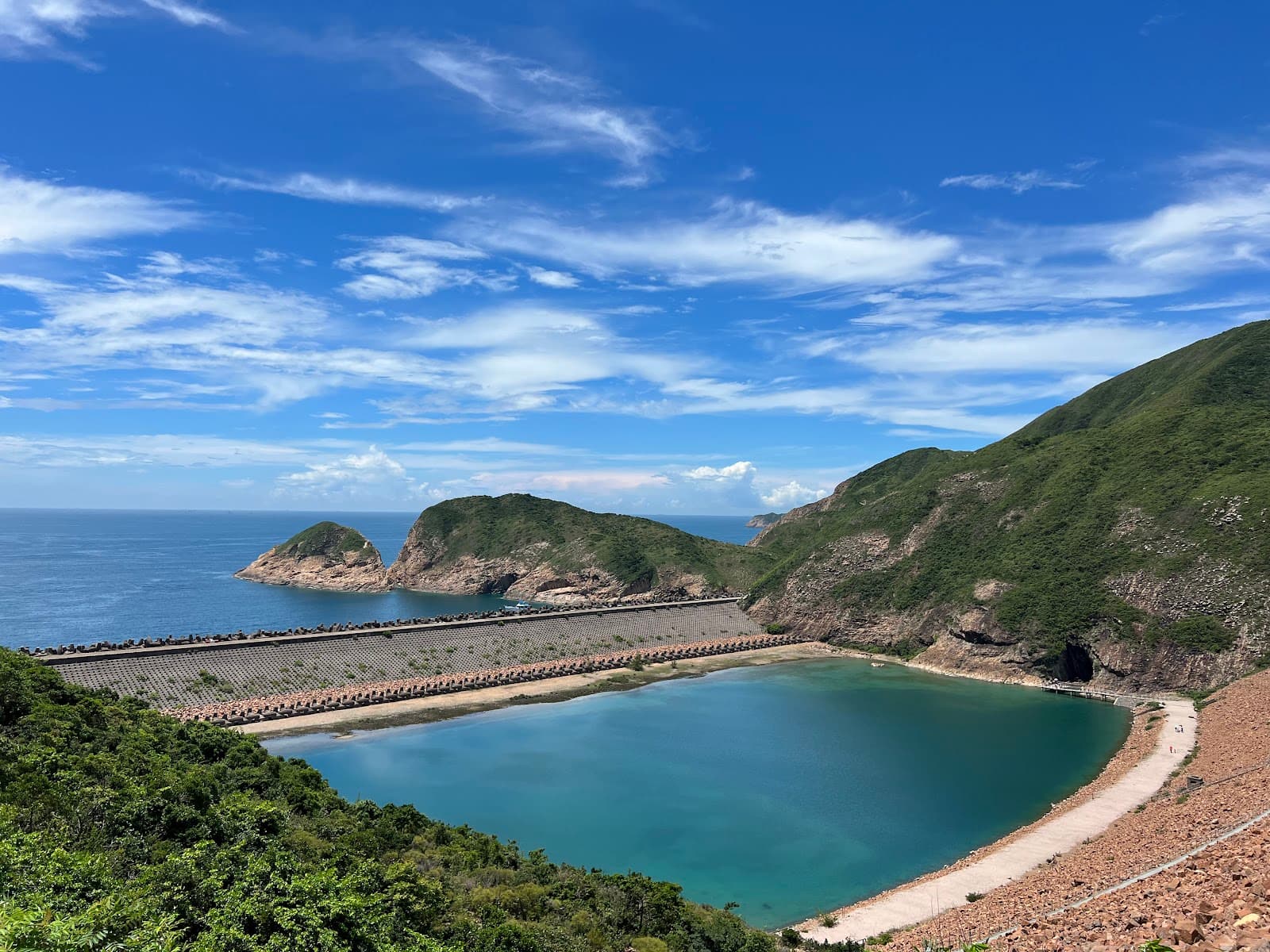
Browse hiking guides: family walks, islands, reservoirs and mountain views
To reach the Po Pin Chau viewpoint, first travel to High Island Reservoir East Dam. Take minibus 9A from Pak Tam Chung when it operates, or a taxi from Sai Kung town or Pak Tam Chung. The walk to the viewpoint begins after you arrive at the dam.
Allow about two hours for the 2 km return Po Pin Chau section, rated three stars, plus transport, queues and breaks. Choose a trail only after planning both journeys and considering your group’s ability. Official trail and starting point.
Getting to East Dam and Po Pin Chau: minibus 9A, taxis and walking
The main public-transport connection is Sai Kung town → KMB 94 → Pak Tam Chung → minibus 9A → East Dam. Routes 96R from Diamond Hill and 289R from Sha Tin also connect on their operating days. Minibus 9A does not start in Sai Kung town.
1. Bus to route 9A: a common weekend option
Reach Pak Tam Chung by bus, then change to green minibus 9A:
- KMB 94 from Sai Kung town: regular daily service
- KMB 96R from Diamond Hill MTR: check the current weekend and public-holiday schedule
- KMB 289R from Sha Tin town centre: check its current special-day schedule
Route 9A regular timetable, checked on 3 October 2026 against the Transport Department route page (page revision: 4 December 2025):
| Item | Regular arrangement |
|---|---|
| Operating days | Saturdays, Sundays and public holidays |
| From Pak Tam Chung | 09:30–18:10 |
| From East Dam | 10:00–18:30 |
| Frequency | About every 15–20 minutes |
| Full-route one-way fare | HK$12.8 per person |
Special services and traffic controls may differ. The government’s 23 September 2026 announcement describes extra 9A services according to Golden Week demand; the regular timetable is not a guarantee for special dates. Check same-day notices and East Dam crowd information.
2. Kaito to High Island, then walk
A less direct alternative uses a scheduled kaito from Sai Kung Public Pier berth 3 to High Island on operating days. From High Island Pier, follow the appropriate path and Sai Kung Man Yee Road toward the East Dam: about 4 km, with roughly one hour quoted as a planning estimate.
This adds village, sea and reservoir scenery but also extra walking. Verify the actual ferry date, timetable and return plan; do not assume an everyday service or that one hour suits every walker.
3. Taxi: a practical weekday option
A taxi from Sai Kung town or Pak Tam Chung can reach the East Dam when road and weather conditions permit. Plan the return too: an outbound taxi does not guarantee one will be waiting later.
4. Walk the approximately 9 km approach from Sheung Yiu
When no 9A service is running, one listed walking approach starts at Sheung Yiu bus stop, follows Tai Mong Tsai Road to the junction and then Sai Kung Man Yee Road. The approach is approximately 9 km one way.
Compare the actual walking commitment:
- Transport to and from the dam: the East Dam section itself is 2.8 km.
- Walking both approach legs: 9 + 2.8 + 9 = approximately 20.8 km
⚠️ This long total applies only if you choose to walk both road legs; it is not compulsory weekday mileage. Consider a taxi and confirm road-access restrictions rather than assuming any private charter can enter. See the Sai Kung hiking transport guide.
Distinguish the three trail sections
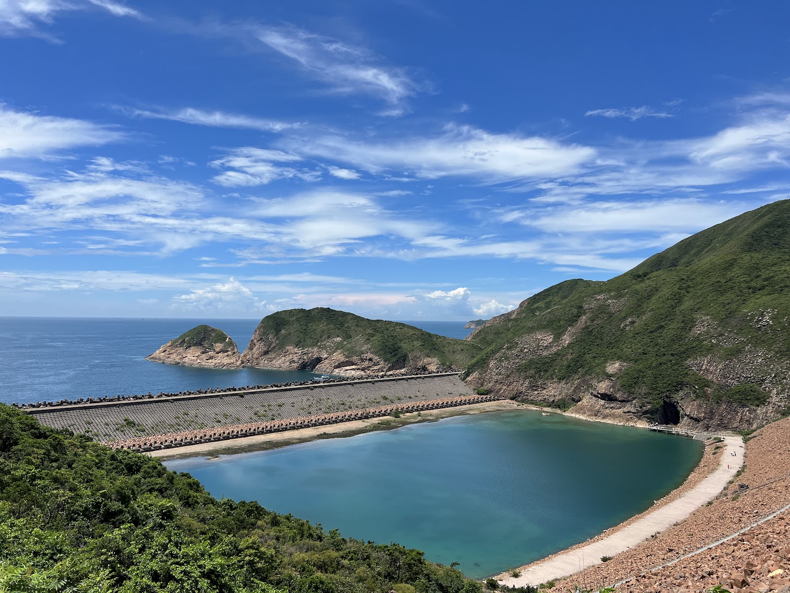
The High Island Geo Trail has three named sections with very different demands. Do not treat an East Dam visit and a Po Pin Chau hike as interchangeable.
| Section | Length | Official time | Difficulty | Ascent | Surface | Booking |
|---|---|---|---|---|---|---|
| East Dam | 2.8 km | 2 h | 1 star — Easy | 1 | 1 | Not required |
| Biu Tsim Kok | 1.8 km | 1.5 h | 2 stars — Moderate | 2 | 2 | Not required |
| Po Pin Chau | 2 km | 2 h | 3 stars — Strenuous | 3 | 4 | Required on specified dates |
Po Pin Chau is only 2 km long but is rated three stars, with surface score 4. The official description indicates about 2 km return, around 200 metres of ascent and two hours on rugged terrain, suitable only for people with hiking experience.
The one-star East Dam section and the three-star Po Pin Chau section therefore call for different preparation. See the Hong Kong hiking difficulty guide for the component ratings.
Po Pin Chau booking trial: September–October 2026
AFCD's trial requires advance booking from 09:00 to 17:00 on the specified dates. During the trial, admission is free.
⚠️ The scheme applies only to the Po Pin Chau section. East Dam and Biu Tsim Kok do not require a reservation under this trial. Outside the specified dates and hours, the booking requirement does not apply; this is not a recommendation to hike after dark or in unsafe weather.
Dates covered by the trial
- 5–6 September 2026
- 12–13 September 2026
- 19–20 September 2026
- 25–27 September 2026, around Mid-Autumn Festival
- 1–7 October 2026, National Day Golden Week
Capacity and entry slots
There are four two-hour entry slots: 09:00–11:00, 11:00–13:00, 13:00–15:00 and 15:00–17:00. Each has 500 places, giving 2,000 per day, allocated first come, first served.
The time selected when booking is the beginning of the entry slot. For example, 09:00 means entry during 09:00–11:00.
How to book
Bookings use real-name registration through the designated Klook website, app or WeChat mini-programme.
- One reservation can cover up to five people—the person booking and up to four companions. Children of every age also need a place.
- Each visitor can make at most two reservations within 14 consecutive days.
- Cancellation is available up to 48 hours before the booked slot begins.
- The electronic voucher includes a QR code and can be received by email or viewed in the relevant app.
The system opened at 11:00 on 24 August 2026. Releases are scheduled for 11:00 on the published Mondays: 24 and 31 August, then 7, 14 and 21 September, for the corresponding visit-date groups above. Check the current official release table rather than assuming a permanent weekly schedule.
Checks at the entrance
Arrive at the entrance within your booked date and slot with your electronic voucher and matching identity document. Staff may check identity. The entrance is beside the route 9A terminus on Sai Kung Man Yee Road.
If a slot has spare capacity, an online booking may be made on site. Do not depend on spare places on a busy day.
Weather-related cancellation
Check the current rules and forecast before travelling:
- Typhoon Signal No. 8 or above, or a Black Rainstorm Warning: subsequent reservations that day are cancelled automatically.
- Typhoon Signal No. 3: the affected slot is cancelled. Entry may resume within three hours after the signal is lowered if site conditions permit. If Signal No. 3 remains in force at noon, later reservations that day are cancelled.
- Amber or Red Rainstorm Warning, a Thunderstorm Warning affecting New Territories East, or a lightning report within 10 km of Sai Kung East Country Park on the specified-location lightning alert service: the affected slot is cancelled; reopening also depends on safe site conditions.
⚠️ Transport has its own weather rule: route 9A is suspended under a Black Rainstorm Warning or Typhoon Signal No. 3 or above. If those warnings are cancelled before noon, services may resume progressively according to road conditions. Its trigger is not identical to every trail-booking cancellation trigger.
For wider planning, see Sai Kung weather and safety conditions.
Geology: the High Island supervolcano
High Island Reservoir East Dam offers close views of Hong Kong's remarkable hexagonal volcanic rock columns. The wider column formation was included among the first 100 IUGS Geological Heritage Sites in 2022.
More than 140 million years ago, major volcanic activity affected the area now occupied by Sai Kung and its waters. The system is commonly described as the High Island supervolcano.
Thick volcanic deposits cooled and solidified into rock. After large eruptions, collapse above the emptied magma chamber formed a caldera, an approximately 20-kilometre-long elliptical depression.
Quarrying associated with reservoir construction exposed striking rhyolitic volcanic columns near the East Dam. Other parts of the Sai Kung volcanic region also have columnar formations; the East Dam is particularly accessible for viewing them on land.
Sharp Island records an earlier phase of this volcanic system, around 143 million years ago, while the columns relate to later activity. For that different geological setting, see the Sharp Island hiking guide.
Choose your itinerary
For the rock columns only
The East Dam section is 2.8 km, around two hours and rated one star. It is comparatively gentle and has interpretation facilities. This section is outside the Po Pin Chau booking scheme.
Add the Po Pin Chau viewpoint
Start near the reservoir monument and follow the designated Po Pin Chau route to the viewpoint, then return the same way: about 2 km, roughly 200 metres of ascent and two hours.
⚠️ A key warning: there is no shade, shelter, resupply point or intermediate exit along the route. Rugged terrain and surface score 4 mean it is for experienced walkers. Book when the trial requires it.
Treat the absence of an intermediate exit seriously: turning back along the designated route is the normal way out.
Walk MacLehose Trail Section 1
The East Dam lies on Section 1 between Pak Tam Chung and Long Ke. The full section is 10.6 km, officially about 3.25 hours and three stars. Its surface score is 2 and much of the approach is paved, but distance and exposure still matter.
You can instead finish your walk at the East Dam if onward transport is arranged. Compare options in the Sai Kung hiking routes guide.
Preparation and safety
Two precautions deserve particular attention:
- Stay behind barriers and away from cliff edges.Weathered cliffs can be unstable. Follow signs and maintained, designated paths.
- Carry enough food and drinking water.Po Pin Chau has no resupply point or shade.
Although the source table does not specify shade for the East Dam section, much of the dam and exposed rock area is open. Avoid peak heat and allow adequate daylight.
Check the official route pages for brochures, route maps and available GPX files, and save the relevant information offline.
Return transport and other plans
Confirm the return journey on arrival before deciding when to turn back. The regular 9A timetable lists 18:30 as the last departure from East Dam, but queues, weather and traffic controls affect arrangements. Reach the stop early. Taking a taxi in does not guarantee one will be waiting for your return; add transport allowances to the walking time.
After returning via Pak Tam Chung to Sai Kung town, consult the changing and shower facilities guide and Sai Kung food guide. Evening congestion varies; staying for dinner may spread out the day but does not guarantee a quicker trip home.
A short East Dam visit with well-arranged transport may leave time for another activity. Browse the Sai Kung water activities guide or Sai Kung one-day itinerary. For equipment options, see rental services.
However, transfers and queues are unpredictable. If you add Po Pin Chau, avoid scheduling a water activity on the same day. Sharp Island may be easier for a combined outing, provided meeting points and activity times are confirmed.
Frequently asked questions
How do I get to Po Pin Chau?
Take an operating 9A minibus or a taxi to East Dam, then follow signs from the Po Pin Chau section entrance to the viewpoint and back. The return walk is about 2 km and two hours, plus transport and breaks. Book ahead on controlled dates.
How much is minibus 9A, and does it run on weekdays?
The regular one-way fare is HK$12.8. Regular service is on Saturdays, Sundays and public holidays: 09:30–18:10 from Pak Tam Chung and 10:00–18:30 from East Dam, about every 15–20 minutes. Check notices for special weekday services and same-day changes.
Do I need a reservation for the East Dam?
The trial covers only the Po Pin Chau section, from 09:00 to 17:00 on 5–6, 12–13, 19–20 and 25–27 September, and 1–7 October 2026. East Dam and Biu Tsim Kok do not require booking under this scheme. Check for later changes.
How do I book Po Pin Chau?
Follow the designated Klook link on AFCD’s booking page. Releases follow the published date table: visits on 1–7 October 2026 opened for booking at 11:00 on 21 September. This is not an indefinite weekly Monday release rule. Check the booking system for availability.
Can I visit on a weekday?
Consider a taxi from Sai Kung town or Pak Tam Chung and arrange your return. Regular 9A service is on Saturdays, Sundays and public holidays; check separate notices for special weekday services. A day without 9A does not mean that you must walk the roughly 9 km approach road.
Is Po Pin Chau difficult?
It is rated three stars, with surface score 4: roughly 2 km return, 200 metres of ascent and two hours. The rugged route is intended for experienced walkers and has no shade, resupply point or intermediate exit.
What happens to a booking in bad weather?
Signal No. 8 or above and Black Rain cancel later slots that day. Signal No. 3 cancels the affected slot and, if still active at noon, later slots. Amber/Red Rain, relevant New Territories East thunderstorm warnings or nearby lightning also cancel affected slots. Route 9A has a separate suspension rule for Black Rain and Signal No. 3 or above; check both trail and transport notices.
Related articles
- Sai Kung hiking routes: compare 31 walks by time, difficulty and shade
- Sai Kung hiking transport: services, holiday limits and extra walking
- Understanding Hong Kong hiking ratings
- Sharp Island: tombolo, rocks and easy trails
- Sai Kung weather and safety conditions
- Getting to Sai Kung by bus and minibus
- Sai Kung one-day itineraries