
Browse hiking guides: family walks, islands, reservoirs and mountain views
Getting to Sai Kung town and reaching a trailhead are separate parts of the journey. One common mistake is assuming minibus 9A leaves from town: it normally runs between Pak Tam Chung and High Island Reservoir East Dam on Saturdays, Sundays and public holidays. Special-date services may be announced separately.
This guide explains major trailhead connections and access walks that can substantially lengthen a hike. For the initial journey from urban Hong Kong to Sai Kung town, see the Sai Kung transport guide.
Separate the journey into stages
Many trips involve the following two stages, although some direct routes let you bypass Sai Kung town:
- Stage 1: urban Hong Kong to Sai Kung town or another interchange.Choose a connection suited to your starting point and allow for traffic. See the Sai Kung transport guide.
- Stage 2: the interchange to the trailhead.Some connections are infrequent, require another transfer or operate only on particular days. Plan this stage before choosing your start time.
The route options below draw on AFCD's Enjoy Hiking transport guidance. Confirm the actual date's service with the Transport Department and operator, since trail pages and older timetables may not reflect temporary changes.
Three useful interchanges
These are useful hubs for many Sai Kung outings, not the only possible starting points.
Sai Kung town
A departure area for Sharp Island kaito services and resident bus NR29 towards Sai Wan Pavilion. Confirm the exact boarding location; different services do not all use the same pier or stop.
Pak Tam Chung
A starting area for MacLehose Section 1 and the minibus 9A terminus for East Dam. If using 9A, reach Pak Tam Chung first. A taxi or another permitted arrangement may offer a different journey.
Wong Shek Pier
The terminus of KMB 94 and an interchange for selected northeast Sai Kung boat services, including routes towards Tap Mun. Check the destination and sailing date rather than assuming all nearby islands have regular service.
Transport references for six routes
The following are planning connections, not a live timetable. ⚠️ Check current notices before travel, including boarding stops, direction, operating days and the last useful departure.
| Trail | Overall rating | Getting to the start | Leaving the finish | Day-of-operation notes |
|---|---|---|---|---|
| Pak Tam Chung Family Walk | 1 star | KMB 33R, 74R, 94 or 96R; minibus 7 or 9 to Pak Tam Chung. |
Walk to Tsak Yue Wu on Pak Tam Road; KMB 94 or 96R, or minibus 7 or 9. |
33R, 74R and 96R normally operate on Saturdays, Sundays and public holidays. |
| Sharp Island Country Trail | 1 star | From Sai Kung, take a kaito ferry to Sharp Island. Confirm the operator's boarding pier. |
Return from Kiu Tsui or Hap Mun Bay only after confirming the ticket and pickup arrangement. | Schedules vary by operator, demand and weather; confirm the last return. |
| High Island Geo Trail, East Dam Section | 1 star | From Pak Tam Chung, take minibus 9A to East Dam when operating. Alternatively, reach Sheung Yiu by an operating bus and allow about 9 km of access walking if not using permitted vehicle transport. |
Return by 9A when operating, a pre-planned taxi arrangement, or a separately planned long walk back. |
9A normally runs on Saturdays, Sundays and public holidays. Check 96R and 289R's operating days too. |
| Cheung Sheung Country Trail | 3 stars | Take minibus 7 to the trail start near Hau Tong Kai on Hoi Ha Road. | From Yung Shue O, the official exit description includes about 4.5 km on the catchwater route to Shui Long Wo on Sai Sha Road. Connections include KMB 99 or 299X and minibus 807B; other listed routes are date-dependent. |
33R, 74R, 99R and 289R are weekend/holiday options; verify the exact service. |
| MacLehose Trail Section 1 (Pak Tam Chung to Long Ke) | 3 stars | KMB 94 or 96R to Sheung Yiu, or minibus 7 or 9 near the Tai Mong Tsai Road/Pak Tam Road junction. |
From Long Ke, walk back to East Dam for an operating 9A or arranged vehicle. Reaching Sai Wan Pavilion for NR29 involves substantial additional hiking, not a nearby bus stop. |
96R and 9A normally operate on Saturdays, Sundays and public holidays. |
| Tai Long Wan Hiking Trail | 4 stars | From Sai Kung town, take resident bus NR29 towards Sai Wan Pavilion at the end of Sai Wan Road. | Finish at Pak Tam Au for KMB 94 or 96R, or minibus 7. |
96R is normally a weekend/holiday service; confirm NR29 separately. |
Two easily missed access walks
A short named trail can become a much longer day once transport access is included. Missing a service does not mean the alternative walk is automatically a safe fallback.
East Dam: walking access can add about 9 km each way
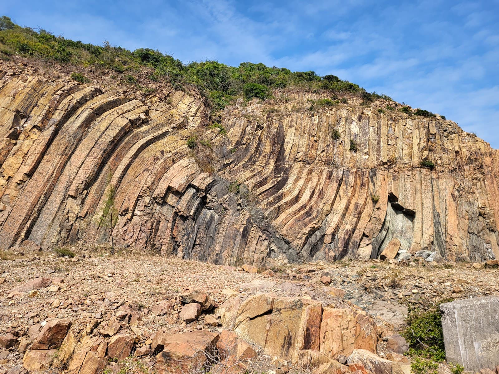
The East Dam geo-trail section is listed as 2.8 km, one star, with a two-hour reference time. Minibus 9A normally operates on Saturdays, Sundays and public holidays, with occasional special-date additions.
If you choose to walk from the Sheung Yiu area, allow about 9 km along the access roads to East Dam. The difference can be substantial:
- Using an operating connection: the 2.8 km trail plus local access and waiting.
- Walking both road legs: 9 + 2.8 + 9 = about 20.8 km in this illustrative plan.
⚠️ That is not an unavoidable weekday itinerary. A taxi or other permitted transport may be possible, but availability, congestion and road controls matter. Arrange the return before departure; do not improvise a long exposed walk late in the day.
Cheung Sheung: the exit walk is part of the day
The named trail is 4.5 km, but AFCD's transport guidance adds roughly 4.5 km from Yung Shue O to Shui Long Wo via the catchwater route.
That makes about 9 km before other access or detours. Include the extra walking in your time, water and daylight plan, and do not assume transport waits at the trail endpoint.
Weekend and holiday services
The issue is not only frequency: some routes do not normally run on ordinary weekdays. Check these services especially carefully:
- Minibus 9A: Pak Tam Chung–East Dam; relevant to the geo trail and the return from MacLehose Section 1.
- KMB 96R: a useful weekend/holiday connection for several trail access points.
- KMB 289R: another date-dependent route serving the broader access corridor.
- KMB 33R and 74R: connections with Pak Tam Chung and the Sai Sha Road corridor.
- KMB 99R: another date-dependent option along the Sai Sha Road corridor.
Regular options include KMB 94, 99 and 299X and minibuses 7 and 9, but verify your stop and direction. A weekday plan may need different connections rather than a different destination. NR29, taxis and operator-confirmed ferries may also be relevant; do not assume only Pak Tam Chung is reachable.
Plan the return first
A missed outward connection can delay you; a missed return can leave you far from reliable transport. Settle these points before starting.
Work backwards from a reliable return service
Check a useful return departure—not merely the final listed one—then subtract the whole walking plan, access legs and a generous contingency to set your start time.
A trail's reference walking time is not the complete door-to-door itinerary. Rest, photos, navigation and queues add time. An apparent four-hour route can need substantially longer, depending on your group and conditions.
Daylight may be the tighter limit
Many paths have no lighting. Set a finish target well before dark, particularly on uneven or steep terrain. For broader conditions, see the Sai Kung weather and safety guide.
Save essential information offline
Signal may be weak or absent, so download timetables, route maps and contact details in advance. Coverage surveys are useful but cannot guarantee reception on every device.
Note distance-post numbers where present and be ready to describe your position and nearby landmarks if you need help.
Driving: convenience and limitations
Driving may simplify one part of the trip, but does not remove transport planning or road restrictions.
First, linear routes finish away from the car.MacLehose Section 1, Cheung Sheung and the Tai Long Wan route have different start and finish points. Plan the journey back to the car, an appropriate return walk or an agreed shuttle; do not discover the gap at the end.
Second, parking can be limited.Sai Kung has several parking options, not just one public car park. Spaces can fill on busy days; park legally and see the Sai Kung parking guide.
Also check current traffic notices and country-park restricted-road permissions. Do not assume that a private car can drive to East Dam or that an old town-centre restriction notice is the only relevant rule.
Short return walks or an island visit with a confirmed return boat may be easier to combine with a parked car, subject to access and parking availability.
After the hike
If your return takes you through Sai Kung town, you can plan changing and food there.
- Changing and showers: confirm access, opening hours and any fees in the Sai Kung changing and shower guide.
- Food: see the Sai Kung food guide. A meal can spread out the day, but it does not guarantee a faster journey home; keep the last onward service in mind.
After a short walk, another activity may be possible only if time, energy and conditions allow. For flexible combinations, the Sai Kung day-trip guide offers ideas. Do not assume a low star rating means the full door-to-door trip takes less than two hours.
Frequently asked questions
Does minibus 9A leave from Sai Kung town for East Dam?
No. Its route is Pak Tam Chung–High Island Reservoir East Dam. Reach Pak Tam Chung first if using it. Normal service is on Saturdays, Sundays and public holidays, but check temporary notices for your exact date.
Can I visit East Dam on a weekday?
Yes, but do not assume the normal 9A service operates. Check special arrangements or plan permitted vehicle transport and the return. Walking from the Sheung Yiu area adds around 9 km each way, making it a very different outing.
Which transport options operate on weekdays?
Regular options include KMB 94, 99 and 299X and minibuses 7 and 9. Other services such as NR29 or ferries require their own date and timetable checks. Do not rely on weekend-only routes without a specific service notice.
How do I reach the Tai Long Wan beaches?
One walking approach uses NR29 from Sai Kung town to Sai Wan Pavilion, then follows the planned trail towards Sai Wan and Ham Tin. A through-hike can finish at Pak Tam Au for road transport. Confirm the exact route and recognise that the four beaches are not all beside one bus stop.
How should I calculate the latest start time?
Work backwards from a safe daylight finish and a reliable return connection. Include the full route, access walks, breaks and a contingency suited to your group. A fixed one-hour buffer is not enough for every outing.