
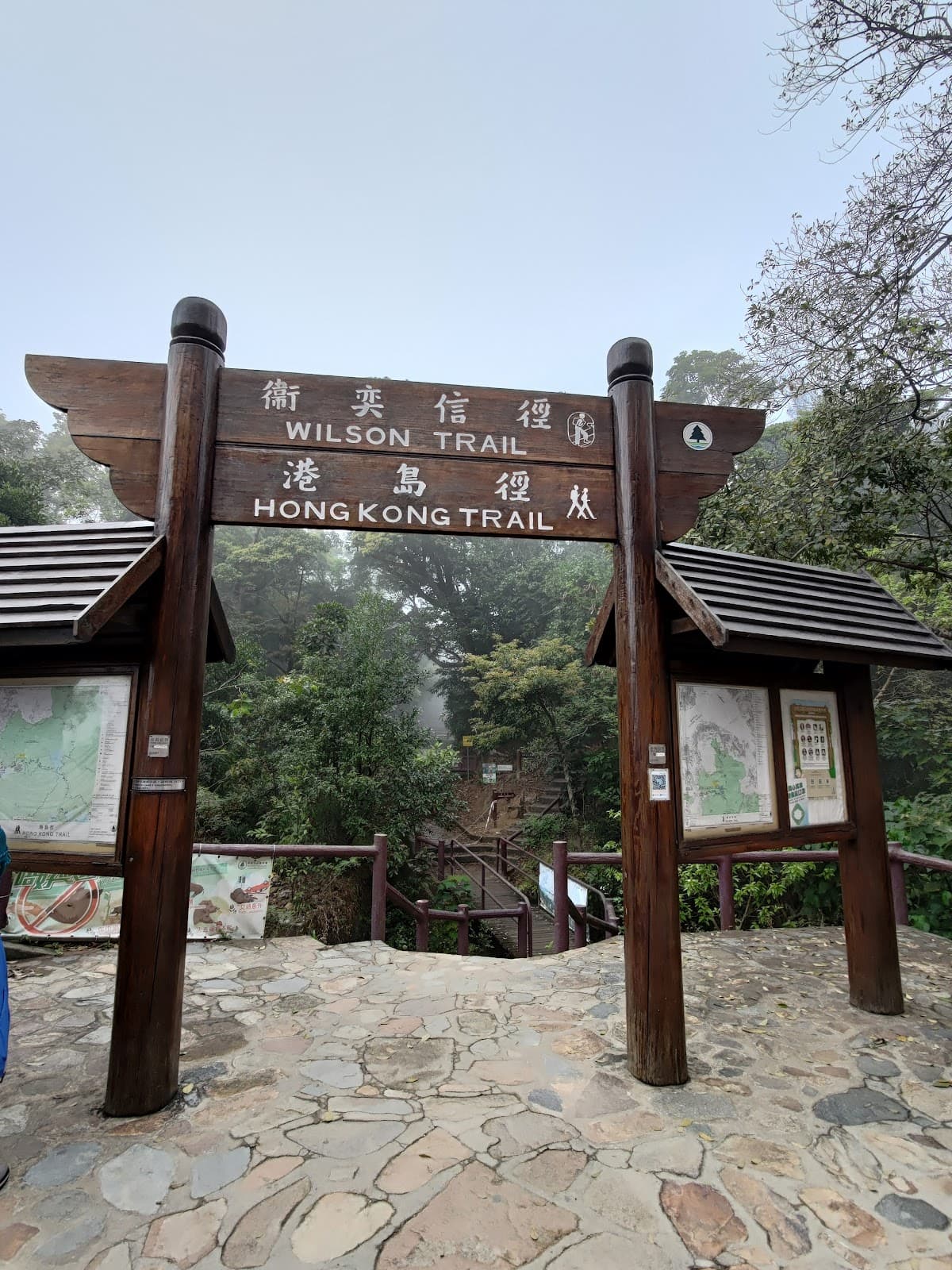
Browse hiking guides: family walks, islands, reservoirs and mountain views
Two walks described as beginner-friendly can feel very different: one may be a short shaded path, another a sustained climb with many steps. The label alone is not enough—you need to understand what is being rated.
AFCD's Enjoy Hiking website provides an overall rating alongside separate measures for distance, time, total ascent and trail surface, plus a shade indicator. Using examples from this guide's 31-route Sai Kung compilation, we explain why kilometres alone do not describe a day's effort. Check current route notices as well as ratings before departure.
The five-star overall scale
AFCD uses five overall difficulty levels. The Chinese labels below identify the official categories; their English descriptions help explain the progression.
| Stars | Category | Sai Kung example | Length | Reference walking time |
|---|---|---|---|---|
| 1 star | Easy (易行) | Pak Tam Chung Family Walk | 1.4 km | 45 minutes |
| 2 stars | Moderate (普通) | Lung Ha Wan Country Trail | 2.5 km | 1.5 hours |
| 3 stars | Strenuous (費力) | Cheung Sheung Country Trail | 4.5 km | 2 hours 15 minutes |
| 4 stars | Difficult (難行) | Tai Long Wan Hiking Trail | 11.4 km | 4 hours |
| 5 stars | Very difficult (非常難行) | MacLehose Trail Section 2: Long Ke to Pak Tam Au | 13.5 km | 5 hours 15 minutes |
These examples differ greatly in length and time, but the star scale is not a linear measure. Two stars do not mean twice the effort of one, and the route's access walks can add considerably to the day.
Read the four component ratings
The overall star rating is a starting point. The separate one-to-five-star measures help explain the demands:
- Distance: the length of the defined route, not necessarily the walk from transport stops.
- Time: a reference duration. Terrain and climbing help explain why similar distances can take different amounts of time.
- Total ascent: the cumulative climbing over the whole route, not just the highest point.This is easy to underestimate.
- Trail surface: AFCD's scale distinguishes easier paths from routes with increasingly many steps; also assess slippery or uneven conditions on the day.
There is a separate shade indicator. Shade affects exposure and heat management, but should not be read as a guarantee that a route is cool or safe in hot weather.
Two equally rated routes can demand different preparation: one may be longer, another involve more climbing or steps. Look at the combination rather than treating the overall rating as a complete description.
Examples: distance does not tell the whole story
The first two comparisons show a shorter route with a higher rating; the third compares similar lengths with different demands. These are rating examples, not confirmation that every route is currently open.
| Comparison | Trail | Length | Overall | Ascent rating | Surface rating |
|---|---|---|---|---|---|
| 1 | Tai Tan Country Trail—check partial-closure notice | 7.2 km | 2 stars, moderate | 2 stars | 2 stars |
| Cheung Sheung Country Trail | 4.5 km | 3 stars, strenuous | 3 stars | 2 stars | |
| 2 | High Island Geo Trail, East Dam Section | 2.8 km | 1 star, easy | 1 star | 1 star |
| Lung Ha Wan Country Trail | 2.5 km | 2 stars, moderate | 2 stars | 3 stars | |
| 3 | MacLehose Trail Section 1 | 10.6 km | 3 stars, strenuous | 3 stars | 2 stars |
| Tai Long Wan Hiking Trail | 11.4 km | 4 stars, difficult | 4 stars | 4 stars |
What the comparisons illustrate:
- Comparison 1: Cheung Sheung is 2.7 km shorter but one overall grade higher. Its ascent rating is higher. Add the access and exit walks when planning an actual trip. Tai Tan's official page currently carries a partial-closure notice following a landslide; do not enter the closed section.
- Comparison 2: the distance differs by only 0.3 km, but Lung Ha Wan has a higher surface rating. Its steps and climbing make it different from the East Dam section.
- Comparison 3: the routes differ by 0.8 km, yet Tai Long Wan has higher ascent and surface scores. MacLehose Section 1 includes substantial paved walking, but its length and exposure still require preparation.
⚠️ The practical lesson: distance, ascent, terrain, exposure and conditions must be considered together. Having completed one 5 km walk does not mean every shorter route is within your ability.
The 31-route compilation in this guide
The following counts describe this article's compilation, not a permanent or exhaustive inventory of every path in Sai Kung. Routes, definitions and notices can change.
| Overall rating | Entries in the compilation | Examples or route types |
|---|---|---|
| 1 star, easy | 14 | Family walks, tree walks, nature trails, some geo trails and Sharp Island Country Trail |
| 2 stars, moderate | 5 | Sheung Yiu, Tai Tan, Lung Ha Wan and the Biu Tsim Kok section |
| 3 stars, strenuous | 6 | Cheung Sheung, High Junk Peak Country Trail, Luk Wu, MacLehose Section 1 and the Po Pin Chau section |
| 4 stars, difficult | 4 | Tai Long Wan, MacLehose Section 3, Wilson Section 3 and Shui Long Wo to Tai Shui Tseng |
| 5 stars, very difficult | 2 | MacLehose Sections 2 and 4 |
The compilation includes many short, lower-rated options but also six four- or five-star entries. Going hiking in Sai Kung does not, by itself, describe the difficulty: the precise route matters.
Another useful clue is that route names describe different kinds of walk. Family walks and tree walks often provide gentler options, while country trails span a wider range. A name is only an initial clue; inspect the actual route and notices.
Choosing a sensible starting point
A rating cannot measure your personal fitness, health, experience or the conditions on the day. Use it to support a conservative choice, not as a pass/fail test.
If you have only walked on urban promenades
Begin with a short, open one-star route, preferably with shade and straightforward access. Pak Tam Chung Family Walk is one example. Allow rests and see how you feel; completing 45 minutes of walking does not automatically qualify you for a higher grade.
If you know paved paths but not uneven trails
Look especially at the surface rating. Lung Ha Wan's 2.5 km route has a three-star surface score despite an overall two-star rating. Choose an open route with manageable steps and footing; do not select Tai Tan without checking the current closure and safe permitted alternative.
If you have completed longer walks and sustained climbs
Some three-star routes may be appropriate. MacLehose Section 1 is a substantial 10.6 km example with a reference time of 3 hours 15 minutes; add transport access, breaks, exposure and the return plan rather than treating its paved sections as effortless.
Progress gradually. There is no universal rule that the biggest jump is between three and four stars: the actual routes differ. Cheung Sheung and Tai Long Wan illustrate how distance, ascent and surface can all change at once.
Official high-risk locations are a separate warning system
AFCD also lists locations with records of fatal or serious accidents. That list is separate from the trail ratings; many such locations are notthe maintained and rated routes described in this guide.
The Sai Kung entries include:
- Sai Kung East: Sharp Peak, Sheung Luk Stream, Yin Tsz Ngam and Kim Chu Wan.
- Sai Kung West: Tam Chai Shan.
⚠️ An important distinction: Sharp Peak is a well-known hiking destination, but it is not one of this guide's 31 rated route entries. It appears on the official high-risk list. Follow AFCD's advice to use maintained routes and avoid these dangerous locations.
A four-star label on a private website is not necessarily an AFCD rating. Equally, absence from one directory alone does not prove that every path is unmaintained. Check the actual manager, waymarking, warnings and route status instead of making either assumption.
Useful official planning resources
Download the official route file where available
Many Enjoy Hiking pages provide GPX files with route information for a compatible phone or watch app. Check the file for the exact trail you intend to use and make maps available offline before leaving.
An official track is a useful reference, not a guarantee of current access, precise GPS reception or a distance post at every point. Follow closures and signs on the ground and carry adequate navigation backup.
Three further checks before departure
- Mobile coverage: consult OFCA's survey information, but do not assume a coverage map guarantees signal on your device in every location.
- Water refill points: check locations and current availability; carry enough water rather than relying on a single unconfirmed refill.
- Distance posts: note the identifiers where present and give rescuers your location and nearby markers if you need help.
For broader weather planning, see the Sai Kung weather and safety guide. Apply activity-specific judgement: a paddling wind threshold is not automatically a hiking rule.
Three consequences of underestimating a route
- Running out of daylight.A reference walking time is not a door-to-door schedule. Add rests, photos, navigation, access and transport waits, and plan a generous daylight margin.
- Losing footing on descent.Steps, loose surfaces, wet ground and fatigue can make descending demanding. Slow down and place your feet carefully rather than assuming the descent is the easy part.
- Finding the exit is farther than expected.Some routes have few convenient exit points. Study them before departure and turn back early when appropriate; do not continue deeper into a route on the assumption that transport will appear nearby.
Frequently asked questions
How many AFCD hiking difficulty levels are there?
There are five overall star levels, from easy to very difficult. Separate ratings for distance, time, total ascent and surface help explain each route. They are planning aids, not guarantees of suitability or current opening.
Why can a shorter trail have a higher rating?
Climbing and terrain matter as well as distance. For example, the listed Cheung Sheung route is 4.5 km with a higher ascent score than the 7.2 km Tai Tan route. Always check current access and closure notices before choosing either.
Which rating should a beginner start with?
Consider a short, currently open one-star route with straightforward access and suitable weather. Shade can help with exposure, but equipment, health, pace and transport still matter. Progress gradually rather than relying on a fixed star-based fitness test.
What is Sharp Peak's official star rating?
Do not substitute a private website's stars for an official rating. Sharp Peak appears on AFCD's list of high-risk locations with serious or fatal accidents; it is not included in this guide's rated trail compilation.
Can I use the reference walking time as my full itinerary?
No. Add breaks, access walks, navigation time and transport waits, then work backwards from daylight and the last reliable transport. A published duration is an estimate, not a deadline to race against.