
Browse hiking guides: family walks, islands, reservoirs and mountain views
MacLehose Trail Section 1 is often considered an introduction to longer walks. That does not mean it is short: the full section is 10.6 km. One reason it is approachable is its surface score of 2 and substantial stretches of gently graded paved road.
This guide compares three ways to walk it. Their physical demands and return-transport arrangements differ considerably; completing the official section is only one option.
Official figures: a long walk with relatively manageable surfaces
| Item | Official figure | Notes |
|---|---|---|
| Length | 10.6 km | Score 3 |
| Reference walking time | 3.25 hours | Score 4 |
| Overall difficulty | 3 stars — Strenuous | — |
| Total ascent | Score 3 | Includes climbs despite gentler road sections |
| Surface | Score 2 | Substantial paved sections |
| Shade | Low | Exposed reservoir and coastal stretches |
Two figures deserve attention.
The time score is 4 while the overall rating is 3 stars.The sustained walking time is a significant part of the challenge. Nevertheless, the component scores describe different measures and should not be read as a simple ranking of all risks.
Surface score 2 is relatively manageable for a three-star route.For comparison, Po Pin Chau has surface score 4 and Luk Wu Country Trail has 3. This helps explain Section 1's appeal as a longer-distance introduction. See the Hong Kong hiking difficulty guide.
⚠️ Shade is low. Reservoir views come with exposure, so avoid peak heat and carry enough water for the actual duration and conditions.
Three ways to walk it
The same starting area can lead to very different distances, time commitments and exit plans.
| Plan | Walking distance | Time allowance | Difficulty | Transport considerations | Best suited to |
|---|---|---|---|---|---|
| A: finish at the East Dam | Roughly 9 km via the approach road; check your exact start | Allow around 3–4 hours or more with sightseeing | Part of the three-star section, not separately graded here | 9A when operating, or a planned taxi | Reservoir and rock-column views without continuing to Long Ke |
| B: complete Section 1 to Long Ke | 10.6 km, plus an exit walk | Allow around 5–6 hours or more including stops and exit | 3 stars | Return to East Dam or continue toward Sai Wan Pavilion | Walkers comfortable with several hours and extra exit distance |
| C: combine Sections 1 and 2 | 24.1 km | A full day; often 10 hours or more | Section 2 is 5 stars | Finish at Pak Tam Au; check last services | Experienced long-distance walkers used to repeated climbs |
A: finish at the East Dam
Walk from Pak Tam Chung beside the reservoir toward the East Dam, visit the designated rock viewpoints, then take available transport back. The dam area includes the boardwalk, breakwater blocks and bent columns; sightseeing can add distance beyond the approach.
⚠️ If relying on route 9A, remember that its normal operation is on Saturdays, Sundays and public holidays. Special weekday service may be announced, and taxis are another option. Without arranged transport, a long road walk remains; it is not inevitable simply because it is a weekday. See the High Island Reservoir East Dam guide for transport and Po Pin Chau reservations.
B: complete Section 1 to Long Ke
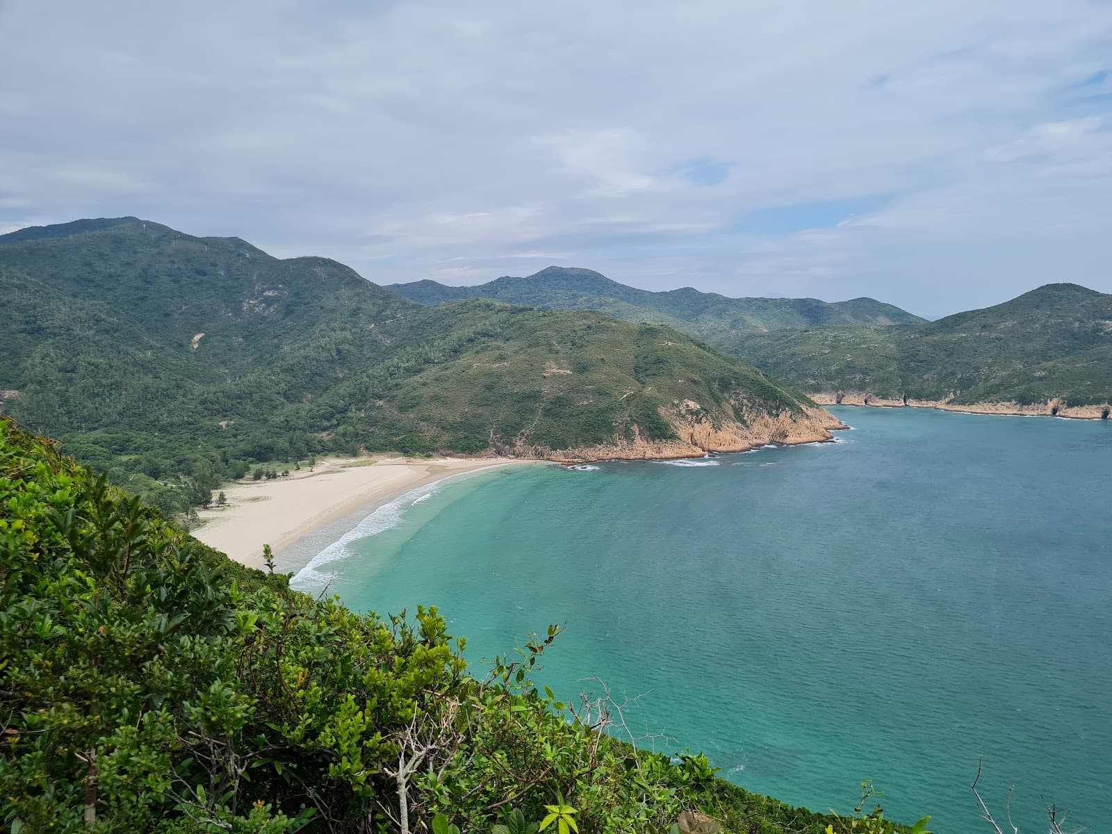
Continue beyond the East Dam to Long Ke Wan to complete the official 10.6 km section. Volcanic rock formations and the bay are highlights. The designated campsite is an option only with suitable equipment, current access information and a proper overnight plan.
The most easily underestimated part is leaving Long Ke.The official route information lists two approaches:
- Walk back to the East Dam for route 9A when it is running, or a separately arranged taxi.
- Continue toward Sai Wan Pavilion for resident bus NR29 to Sai Kung Town Hall, subject to its current schedule.
Both require additional walking. Long Ke has no direct public road transport; include the terrain and distance of the chosen exit in your plan.
C: combine Sections 1 and 2
Walking both sections is a substantial undertaking, not a small extension. Their ratings differ markedly:
| Section | Length | Official time | Difficulty | Ascent | Surface |
|---|---|---|---|---|---|
| Section 1: Pak Tam Chung–Long Ke | 10.6 km | 3.25 h | 3 stars — Strenuous | 3 | 2 |
| Section 2: Long Ke–Pak Tam Au | 13.5 km | 5.25 h | 5 stars — Very difficult | 5 | 4 |
| Combined | 24.1 km | 8.5 h | — | — | — |
⚠️ Section 2 is rated five stars, with ascent score 5 and surface score 4. The reference times total 8.5 hours before breaks; a real outing may take 10 hours or more, depending on pace and conditions.
Section 2 starts with the demanding climb toward 314-metre Sai Wan Shan before descending toward Sai Wan, then continuing through Ham Tin, Tai Long Au and Chek Keng. It requires its own detailed route and exit plan.
Do not jump straight from a manageable three-star outing to the combined route.First build comparable distance and climbing experience. Finishing Section 1 with energy to spare is useful, but does not by itself prove readiness for a five-star continuation.
Route breakdown
Pak Tam Chung to the West Dam
Follow Man Yee Road from the Pak Tam Chung starting area. Much of the early route is paved and relatively gentle. The country park visitor centre is in the starting area.
West Dam to East Dam: beside the reservoir
High Island Reservoir, completed in 1979, dominates the views. Its construction involved major engineering works and relocation of local communities; avoid confusing displaced residents or households with a count of villages.
Much of this open reservoir stretch has little shade.
Around the East Dam
The dam area brings together the boardwalk, thousands of breakwater blocks, bent hexagonal columns and views toward Po Pin Chau. Use designated viewpoints and stay off the breakwater structures.
⚠️ The Po Pin Chau viewpoint walk is a separate three-star route: about 2 km return, 200 metres of ascent, two hours and surface score 4. Specified dates in September–October 2026 require a Klook reservation. See the East Dam guide.
East Dam to Long Ke Wan
This final part completes Section 1. Long Ke's coast has distinctive volcanic formations and a designated campsite. Overnight visitors must plan food, water, equipment and current campsite conditions; clear skies are not guaranteed.
Transport: start and finish are different
Starting area: Pak Tam Chung
Official access information lists:
- Public transport to Sheung Yiu bus stop: KMB 94, with 96R on its operating days; check current timetables.
- Green minibuses 7 or 9 to the junction of Tai Mong Tsai Road and Pak Tam Road.
These regular starting-area services make weekday access possible, but still check the actual route and departure times.
Finishing point: depends on your plan
| Plan | Finish | Exit | Weekday option |
|---|---|---|---|
| A | East Dam | 9A when running, or taxi | Yes, with a confirmed plan; do not assume a normal weekday 9A service |
| B | Long Ke | Walk back to East Dam, or onward to Sai Wan Pavilion for NR29 | Check NR29 timing and the extra walk |
| C | Pak Tam Au | KMB 94, minibus 7, or 96R on operating days | Check current 94 and 7 services |
⚠️ This is a point-to-point route, so driving needs a car-retrieval plan. A car left near Pak Tam Chung will not be waiting at Long Ke or Pak Tam Au. A return-to-start itinerary can be simpler, but parking availability and transport still need checking.
Compare trail access in the Sai Kung hiking transport guide and town connections in the Sai Kung transport guide.
Food and water
⚠️ Reliable supplies are limited. Carry enough drinking water for the whole planned route and its exit, not just the official 3.25-hour reference time.
Check AFCD's water-refill information for actual locations and availability. Save maps and return timetables offline because mobile coverage is uneven.
In an emergency, give your position and the nearest distance-post number if available. The official GPX file can support navigation, but should not replace an offline map, route understanding and a charged device.
Timing the day
The official 3.25 hours does not include your sightseeing, rests, waiting or extra exit walking. The East Dam can easily become a lengthy stop.
Work backward from both the last usable transport and sunset, subtracting a realistic time for every leg plus a generous contingency. A fixed one-hour buffer is not adequate for every group or condition.
In autumn and winter, daylight may be the tighter limit. Avoid relying on an unlit road as a safe after-dark fallback; plan to finish in daylight. See Sai Kung weather and safety conditions.
Who should choose this route?
Why it can suit a longer-distance introduction
Its relatively manageable surface and long paved sections reduce some technical demands. Distance, climbing and exposure still require fitness and judgment; they are not automatically solved by an early start.
The East Dam can serve as a planned finish if transport is confirmed. Do not treat it as a guaranteed immediate escape when queues, weather or taxi availability intervene.
When to choose a shorter walk first
If you have not comfortably completed walks of more than two hours, start with a shorter one- or two-star route. Our Sai Kung compilation includes 14 one-star routes, with several short options around Pak Tam Chung; this is an article selection, not a permanent official inventory.
Compare time, difficulty and shade in the Sai Kung hiking routes guide.
After the walk
Depending on your return transport, you may pass Pak Tam Chung or Sai Kung town. For facilities and food, see the changing and shower guide and Sai Kung food guide. Evening traffic can be busy; allow flexibility rather than assuming dinner always saves travel time.
This route can take most or all of the day. Avoid adding a scheduled water activity afterward. A shorter Sharp Island walk may be easier to combine with an activity, but confirm meeting points and timing separately. See the Sharp Island hiking guide and Sai Kung water activities guide.
Frequently asked questions
Is MacLehose Trail Section 1 difficult?
It is rated three stars, with 10.6 km and a reference time of 3.25 hours. Surface score 2 reflects relatively manageable terrain with substantial paved stretches, but low shade, distance and additional exit walking can make the outing demanding.
How long does Section 1 take?
The official reference is 3.25 hours, excluding stops and transport. Allow roughly 5–6 hours or more for a full outing with the chosen exit. Finishing at the East Dam is shorter, but the approach is still around 9 km depending on the exact start and sightseeing, not a guaranteed 7 km walk.
How long do Sections 1 and 2 take together?
They total 24.1 km and 8.5 hours of official reference walking time. With breaks, 10 hours or more may be needed. Section 2 is five stars with major climbing; the combination is for appropriately experienced and prepared walkers.
How do I leave Long Ke?
There is no direct public road transport. Walk back to the East Dam for an operating 9A service or arranged taxi, or continue toward Sai Wan Pavilion for NR29. Both add walking, and the latter includes demanding terrain; check the route and last departure beforehand.
Can I drive to the starting area?
You can consider it where lawful parking is available, but a point-to-point walk needs a return-to-car plan. Finishing at the East Dam with transport back is one option; finishing at Long Ke or Pak Tam Au requires extra arrangements.
Related articles
- Sai Kung hiking routes: compare 31 walks
- High Island East Dam: columns, Po Pin Chau reservations and transport
- Understanding Hong Kong hiking difficulty ratings
- Sai Kung hiking transport guide
- Sharp Island: tides, rocks and easy trails
- Sai Kung weather and safety conditions
- Getting to Sai Kung by bus and minibus