
Miyako and Yaeyama Water Activities 2026: Kabira Bay, Iriomote Mangroves and Yonaha Maehama
After Okinawa's main island, Miyako and the Yaeyama Islands are a natural next step: clear water, quieter settings, mangroves and offshore islands create a very different landscape. But there is one distinction to make before planning:Beautiful water is not necessarily water you may enter.
Kayarine has spent over five years running water activities in Sai Kung and introducing thousands of visitors to its coastline. This guide focuses on where paddling and snorkeling are suitable, where restrictions apply, and how to avoid letting island transfers derail your itinerary.
1. Three destinations at a glance
| Location | Island | Water access | Main activities | Difficulty | Highlights |
|---|---|---|---|---|---|
| Kabira Bay | Northwestern Ishigaki | No swimming | Glass-bottom sightseeing boats | — | National scenic site within a specially protected national-park landscape |
| Iriomote mangrove waterways | Iriomote | Guided paddling where permitted | Kayaking and mangrove interpretation | ⭐ Beginner, subject to conditions | Sheltered waterways and subtropical ecosystems |
| Yonaha Maehama | Southwestern Miyako | Where permitted and conditions allow | SUP, swimming and water activities | ⭐ Beginner, subject to conditions | A long white-sand beach; confirm seasonal safety arrangements |
2. Kabira Bay, Ishigaki: sightseeing, not swimming
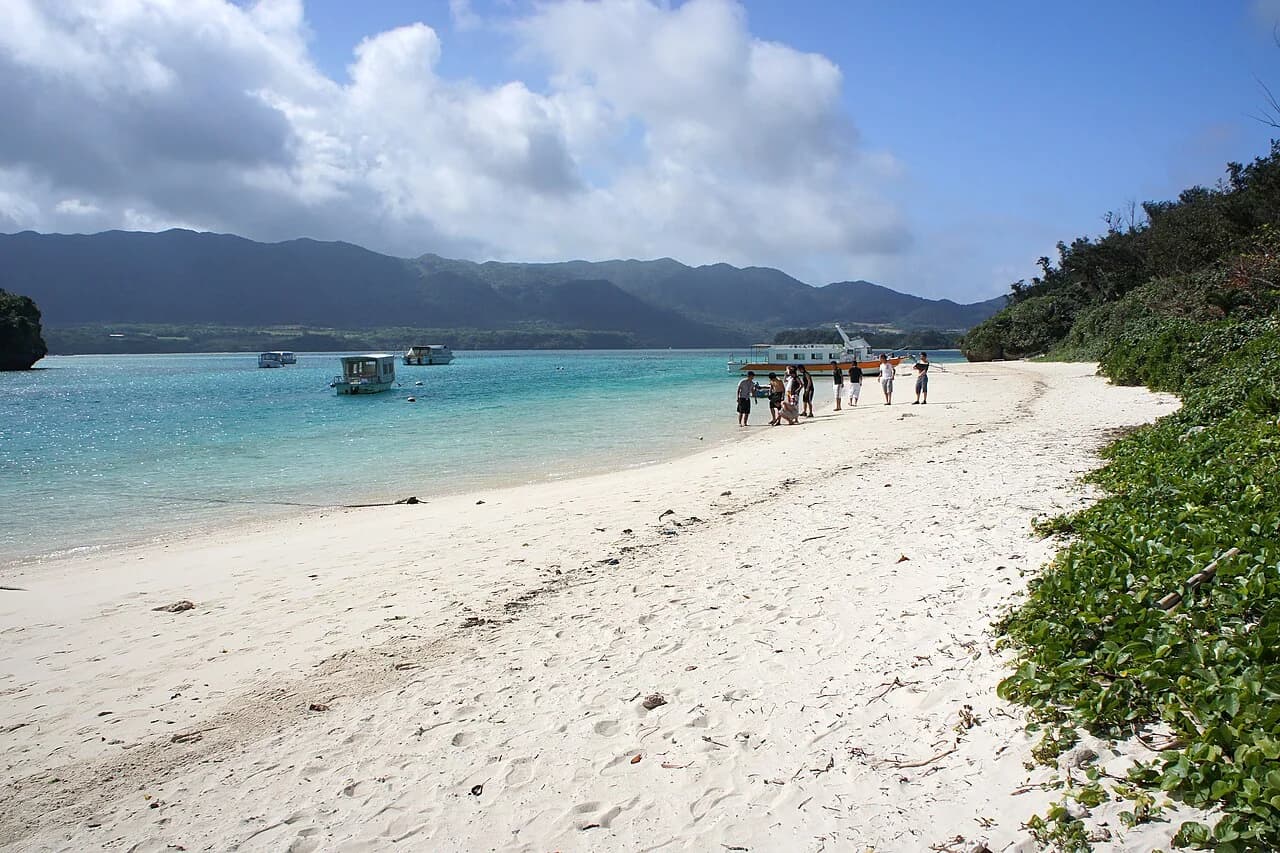
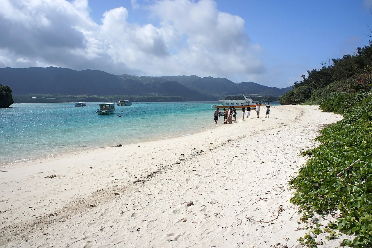
Kabira Bay lies in northwestern Ishigaki, with small islands near its mouth and coral communities beneath water that changes color with the light and tide. The bay is one of the island's best-known scenic locations. Kabira Bay and Mount Omoto received national scenic-site designation in 1997. When the park expanded in 2007 to become Iriomote-Ishigaki National Park, the bay became part of its specially protected landscape.
⚠️ Important restriction: Kabira Bay has strong currents and swimming is prohibited. Glass-bottom sightseeing boats provide a way to see the coral scenery. Online references to snorkeling in Kabira Bay can be misleading: arrange a different suitable location with an operator instead of entering the bay yourself. Black-pearl farming and sensitive coastal habitats also make water-quality protection important here.
3. Iriomote mangroves: sheltered guided paddling
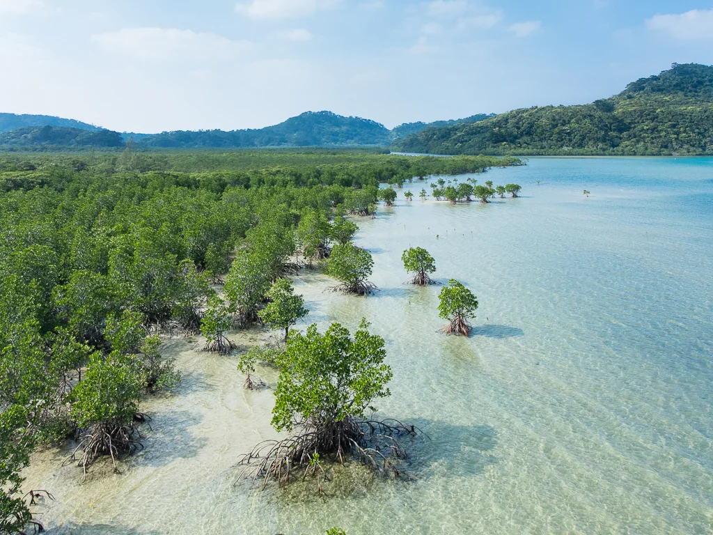
Iriomote is the largest of the Yaeyama Islands and Okinawa Prefecture's second-largest island, covering roughly 289 square kilometers. Its population and infrastructure are limited, with a coastal road connecting settlements in the north and east. Extensive mangrove wetlands remain a defining feature of the island.
- Why beginners like it: Sheltered mangrove channels are less exposed to ocean swell, and guided trips often combine gentle paddling with ecological interpretation. Suitability for beginners and children still depends on river conditions, weather and the operator's requirements.
- Getting there: Iriomote has no airport. Travel to Ishigaki first, then take a ferry to Uehara in the northeast or Ohara in the southeast. Uehara services are particularly exposed to disruption; confirm whether an alternative arrival at Ohara and an onward transfer are available.
- Suggested pace: A day trip from Ishigaki is possible, but staying overnight gives you more time if you want both mangrove kayaking and other island activities. Check accommodation and transport before booking.
4. Yonaha Maehama, Miyako: SUP beside a white-sand beach
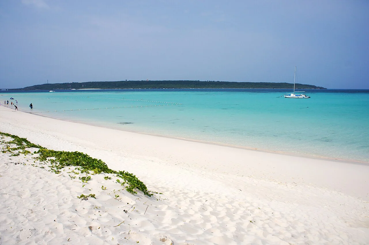
Yonaha Maehama stretches for around seven kilometers along southwestern Miyako, facing Kurima Island. Kurima Bridge connects the islands near the southeastern end. The beach has appeared prominently in past traveler rankings, but historical rankings or water-quality surveys are not a substitute for checking conditions on the day.
- Facilities: Parking, changing facilities, showers, toilets and food outlets are associated with the beach area. Opening arrangements vary; ask locally about the exact supervised swimming area and whether lifeguards or jellyfish nets are operating. Do not assume the whole beach is protected.
- Choosing an operator: Check that your provider has the permissions and safety arrangements required for its operating area. Ask about staff supervision, equipment and cancellation criteria rather than choosing on price alone.
- Changing shoreline: Erosion and typhoons can change the beach and access points substantially. Old photographs may not reflect the present shoreline, so use current signs and local advice when deciding where to enter.
- Special events: The Miyakojima triathlon has used this beach as its swim start. Confirm the event schedule and any access restrictions before your trip.
5. Seasons and ferries: build flexibility into the itinerary
| Season | Conditions and ferries | Planning advice |
|---|---|---|
| April–June | Warming water; rain and rough weather remain possible | A useful planning window, with weather contingencies |
| July–September | Warm water, but typhoons can interrupt ferries | Allow flexible days and book activities with clear cancellation terms |
| October | Often quieter; typhoons and rough seas are still possible | Another option, subject to the forecast |
| November–March | Seasonal winds can disrupt exposed-water trips | Ask about sheltered options; these are not weather-proof |
An island itinerary depends on both activity conditions and the ferry connection. Ishigaki–Iriomote services can be disrupted by wind and waves. Schedule transfer-dependent activities early enough to leave a backup day, and return to your departure island before flight day. Mangrove trips may be sheltered, but getting to Iriomote still requires a functioning ferry service; heavy rain can also affect rivers.
6. Protected areas and safety
- Confirm access before entering: National-park zones and scenic sites have location-specific restrictions. Follow posted rules and the operator's instructions about swimming, landing and coral protection.
- Do not stand on coral or touch wildlife: Even a single step can damage fragile coral. Maintain enough distance to avoid contact.
- Sun protection with less environmental impact: Prioritize protective clothing and shade, and follow local sunscreen guidance. A product's reef-friendly label does not guarantee it has no environmental impact.
- Buoyancy aids and suitable SUP leashes: Wear a correctly fitted lifejacket or buoyancy aid appropriate to the activity. Let a qualified guide specify whether a leash is appropriate and which release system to use; an ankle leash can create an entrapment hazard in moving river water.
- Long-sleeved sun-protective clothing: Clothing can reduce sun exposure and some minor contact injuries, but does not make you immune to stings or cuts. See our sun-protective clothing guide.
- Check wind and sea conditions daily: If conditions exceed the operator's limits, warnings are issued or a red flag is displayed, change plans rather than entering the water.
7. Practice in Sai Kung before the trip
Miyako and Yaeyama reward time spent enjoying nature. Practicing basic paddling, turning, balance and getting back onto your craft beforehand can help you make more of a guided outing abroad.
In suitable conditions, sheltered Sai Kung bays offer a convenient place to develop confidence. Some guided itineraries combine kayaking and snorkeling in a single day.
👉 Book the Sharp Island kayaking and snorkeling experience to build confidence; experienced paddlers can also rent a kayak or SUP, or explore all water activities.
8. Frequently asked questions
Can I swim or snorkel in Kabira Bay?
No. Swimming is prohibited because of strong currents, and glass-bottom boats are the usual way to view the bay's underwater scenery. If you want to enter the water on Ishigaki, book a suitable alternative site with an operator rather than entering Kabira Bay yourself.
How do I reach Iriomote, and does it have an airport?
Iriomote has no airport. Most visitors arrive via Ishigaki and take a ferry to Uehara or Ohara. Confirm the sailing and onward transfer with your operator: weather can affect the ports differently, and transport on the island is limited.
Is Miyako or Yaeyama better for beginner SUP?
A permitted, sheltered beach area on Miyako can work well in calm conditions. Guided mangrove trips on Iriomote provide another sheltered option. Neither is automatically safe: the guide must assess wind, tide, currents and the group's abilities. Offshore snorkeling in both areas depends on conditions.
Does Yonaha Maehama have lifeguards and jellyfish nets?
Do not assume that the whole beach is supervised or netted. Confirm current seasonal arrangements and the designated swimming area locally. The beach area has visitor facilities, but erosion and weather can change access and conditions; follow on-site guidance.
When is a good time for water activities in Miyako and Yaeyama?
April–June and October are possible planning windows, but neither guarantees settled weather. Summer has warm water and typhoon-related disruption; winter winds can cancel exposed-water trips. Leave flexibility for ferry-dependent activities and check forecasts throughout your stay.