
Western New Territories Water Activities 2026: Castle Peak Bay, Butterfly Beach and Lung Kwu Tan
The western New Territories offer convenient transport, developed beach facilities and expansive sunset views. Yet this coastline needs careful planning: not every beach is a suitable place to enter the water, and water conditions vary considerably.
Kayarine has spent over five years running water activities in Sai Kung and introducing thousands of visitors to its coastline. This guide looks at western Hong Kong from a paddler's perspective: supervised beaches, places better enjoyed from shore, and why the water looks different from Sai Kung.
1. Coastal locations compared
| Location | Water access | Lifeguards | Activities | Difficulty | Notes |
|---|---|---|---|---|---|
| Castle Peak Beach | Swimming when open and conditions allow | LCSD service; check operating hours | Swimming; confirm a separate permitted paddling launch | ⭐ Conditions dependent | Check the latest water-quality information |
| Kadoorie and Cafeteria beaches | Swimming when open and conditions allow | LCSD service; check operating hours | Swimming; ask about local paddling access | ⭐ Conditions dependent | Neighboring beach areas; crowd levels vary |
| Golden Beach | Swimming when open and conditions allow | LCSD service; check operating hours | Swimming; verify any kayak or SUP arrangement separately | ⭐ Conditions dependent | Beside Hong Kong Gold Coast, with visitor facilities |
| Butterfly Beach | Swimming when open and conditions allow | LCSD service; check operating hours | Swimming and shore-based recreation | ⭐ Conditions dependent | A long beach on the western side of the bay |
| Lung Kwu Tan | Not recommended for casual swimming | No supervised bathing service | Sunsets and shore-based wildlife observation | — | Not a supervised bathing beach |
| Ha Pak Nai | Mudflat, not a swimming launch | None | Sunsets and low-impact nature observation | — | Sensitive mudflat and mangrove habitats |
2. Castle Peak Bay: Tuen Mun's developed coastline
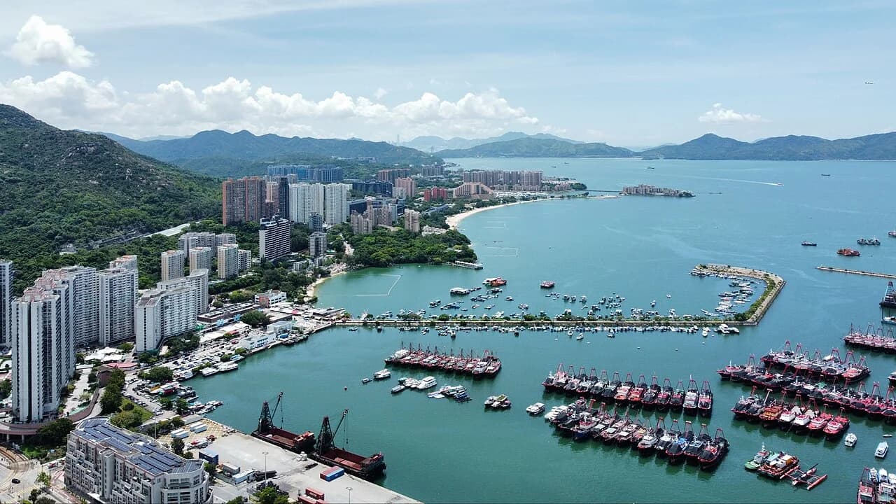
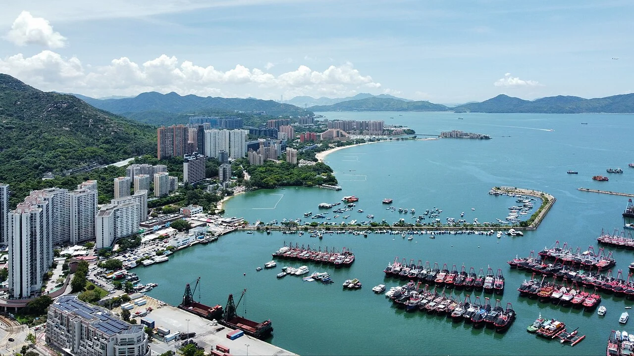
Castle Peak Bay, also known as Tuen Mun Bay, fronts the southwestern side of Castle Peak Road between the Castle Peak Bay and So Kwun Wat sections. It faces waters near The Brothers Marine Park and the Urmston Road shipping channel. The bay was once much larger: reclamation for Tuen Mun New Town in the 1970s and 1980s substantially changed its shoreline, with the Tuen Mun River forming part of the developed landscape.
Five beaches along the eastern shore
The eastern shore has Castle Peak, Kadoorie, Cafeteria Old, Cafeteria New and Golden beaches, with Butterfly Beach on the western side. Kadoorie Public Pier interrupts part of the shoreline between Castle Peak and Kadoorie beaches. These are LCSD-managed bathing beaches with scheduled lifeguard services, not a guarantee of supervision at all times. Check current facilities and service hours. A designated swimming area should not be assumed to be an authorized kayak or SUP launch.
Understanding water quality
Castle Peak Beach closed because of pollution in 1981. Improvements followed over subsequent years, and historical assessments reported Grade 2 water quality before its reopening on 1 June 2005, with some later periods reaching Grade 1. These historical grades do not tell you whether it is suitable to swim today: check the Environmental Protection Department's latest information and on-site flags.
Butterfly Beach is closer to the Pearl River estuary and can be affected by floating debris, runoff and local coastal conditions. Historical pollution or construction references are not a current assessment. Check today's water-quality information, visible conditions and beach notices, especially after heavy rain.
3. Lung Kwu Tan: enjoy the view from shore
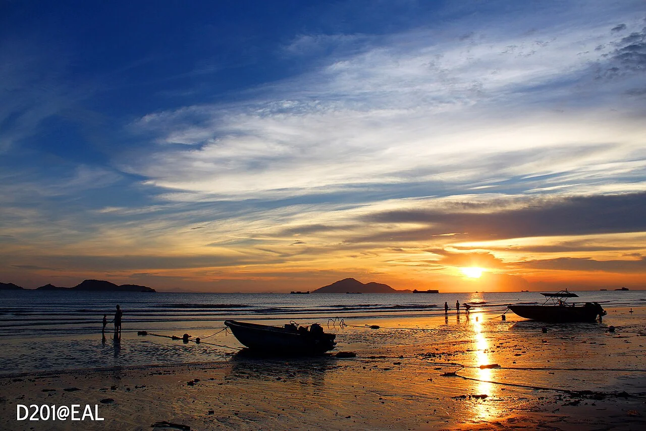
Lung Kwu Tan lies on Tuen Mun's western coast. Its long, curved beach includes dark sand, with major power stations in the wider area and village and barbecue facilities nearby. It offers a different landscape from Hong Kong's developed bathing beaches.
⚠️ Why not treat it as a swimming beach?: Water conditions and debris can vary, and there is no supervised bathing service or managed swimming enclosure. A social-media description of a hidden beach is not evidence that it is suitable for swimming. For a casual visit, stay on shore.
Reasons to visit
- Sunsets and distant views: The broad westward outlook makes the area a well-known sunset spot. Distant visibility depends on weather and haze; plan around the forecast rather than expecting a particular skyline.
- Chinese white dolphins: The wider western waters form part of the dolphins' habitat. North of the beach, the Chinese White Dolphin Lookout offers a shore-based viewpoint. Treat any dolphin sighting as a chance encounter, not a guaranteed attraction.
- Ecological interest: Village woodland and nearby scrub provide habitat for butterflies and other wildlife. Historical AFCD surveys recorded a wide variety of butterfly species in the area. Observe from existing paths and avoid disturbing vegetation.
4. Marine parks and Chinese white dolphins
Two established marine parks help explain the ecological importance of western waters, although they are not the only protected areas in the region:
- Sha Chau and Lung Kwu Chau Marine Park: Designated in 1996, this approximately 1,200-hectare park includes waters around Lung Kwu Chau, Sha Chau and Pak Chau. Estuarine influence supports marine food resources and habitat used by Chinese white dolphins.
- The Brothers Marine Park: Designated in 2016, this park covers roughly 970 hectares. It was established to protect Chinese white dolphins and their habitat, with a core area supporting conservation of fisheries resources. Avoid relying on old rankings of Hong Kong's largest parks, as new parks have since been designated.
⚠️ Marine-park regulations: Marine parks regulate activities including fishing and disturbance of wildlife. Check the AFCD's current rules, permits, boundaries and designated areas before planning a visit. Protection status is not an assurance that a route is safe for a small craft; busy shipping waters require separate consideration.
Why the water is often less clear
The Pearl River brings freshwater and suspended sediment into western Hong Kong waters, affecting salinity and visibility. Chinese white dolphins use coastal and estuarine habitats in this region. Turbidity alone is not a reliable measure of pollution or swimming safety, and dolphin presence does not prove water is suitable for recreation.
A practical way to choose is: consider the west for accessible coastal outings and sunsets, and Sai Kung for suitable guided snorkeling opportunities. These are different experiences, and clear water is never guaranteed at either destination.
5. Ha Pak Nai: mudflats and mangroves, not a swimming spot
Pak Nai faces Deep Bay and Shekou from western Yuen Long. Its coastline includes mudflats, mangroves and oyster-growing areas. The wider landscape includes habitats recognized for special scientific interest, but designation boundaries are specific and should not be assumed to cover every stretch of shore. Oyster shells remain across parts of the flats.
Visit for birdwatching, sunsets and quiet nature observation, not as a casual swimming or paddling launch. Walking across sensitive mud can damage seedlings and bottom-dwelling wildlife, while shells can cut feet. The original transport options include green minibus 33; confirm the current route, return service and last departure rather than relying on an old timetable.
6. Seasons and transport
| Season | Typical conditions | Planning advice |
|---|---|---|
| October–December | Often drier, with northeast-monsoon winds possible | Good potential for shore-based sunsets; assess wind before paddling |
| March–May | Water warms, but wind, fog and rain vary | Choose a suitable guided session rather than assuming calm seas |
| June–September | Warm water, with thunderstorms and tropical-cyclone risk | Follow weather warnings and watch for runoff and debris |
| January–February | Cooler weather and monsoon winds | Consider shore-based plans; shelter does not guarantee safe water |
Transport: Buses and, for some areas, Light Rail connections make Tuen Mun's coast accessible from the town center. Allow for the actual stop, walking distance and traffic rather than a fixed journey time. For comparison, see our Sai Kung transport guide.
7. Safety essentials
- Swim only when supervision and conditions are suitable: Check lifeguard hours, beach notices and water-quality information. Paddling requires its own permitted launch, route and safety arrangements; bathing-beach lifeguards are not a substitute for a paddling guide.
- Respect the red flag: Do not enter because the surface looks calm. Follow staff instructions and leave the water when directed.
- Wear appropriate flotation and use a suitable SUP safety system: Wind-driven drift is particularly serious near terminals and shipping channels. Use correctly fitted equipment and ask a qualified guide about an environment-appropriate leash and release arrangement.
- Stay away from channels and piers: Urmston Road is a busy shipping route. Large-vessel wakes, movement and restricted maneuverability create real hazards for small craft; do not paddle into vessel traffic.
- Watch for floating debris: Runoff can bring hard objects, ropes and other hazards into coastal water. Change plans if conditions are unsuitable.
- Long-sleeved sun protection: Open shorelines offer limited shade and reflected sunlight adds exposure. See our sun-protective clothing guide.
8. For island scenery and snorkeling, consider Sai Kung
Western Hong Kong offers convenience and sunset views. If your priority is island scenery and snorkeling, Sai Kung provides another option, subject to weather and visibility. Around Sharp Island, suitable guided outings combine kayaking and snorkeling in one day; water clarity is not guaranteed.
👉 Book the Sharp Island kayaking and snorkeling experience. Experienced paddlers who can plan a safe route may also rent a kayak or SUP, or browse all water activities.
9. Frequently asked questions
Which western New Territories beach suits a beginner kayak or SUP session?
Castle Peak Bay has several developed bathing beaches, but swimming facilities do not automatically authorize paddling. Ask an experienced local operator to identify a permitted launch and suitable sheltered route. Check wind, water quality, traffic and supervision rather than assuming any lifeguarded beach is suitable for a first paddle.
Can I swim at Lung Kwu Tan?
It is not recommended for a casual swimming visit. There is no supervised bathing service, and conditions and debris can vary. Treat it as a shore-based sunset or nature outing. The nearby dolphin lookout provides a viewpoint, but sightings are never guaranteed.
Is the water at Castle Peak Beach good?
Its water quality improved after a pollution-related closure, and the beach reopened in 2005. Historical Grade 1 or Grade 2 results are not today's assessment. Check the Environmental Protection Department's latest beach information, local flags and notices, especially after heavy rain.
Why is western Hong Kong water often murkier than Sai Kung?
Freshwater and sediment from the Pearl River affect western waters, lowering salinity and visibility. This estuarine environment supports different habitats. Cloudiness alone does not establish pollution levels or safety; choose activities using current water-quality information and conditions.
When is a good season for western New Territories water activities?
Autumn and early winter can offer pleasant shore-based outings, but northeast-monsoon winds may still make paddling unsuitable. Summer brings warm water alongside thunderstorms and tropical-cyclone risk. Choose the day by its forecast, warnings, water quality and operator assessment rather than the month alone.