
Kowloon Waterfront History Walk 2026: Lei Yue Mun, the Four Hills and Kai Tak
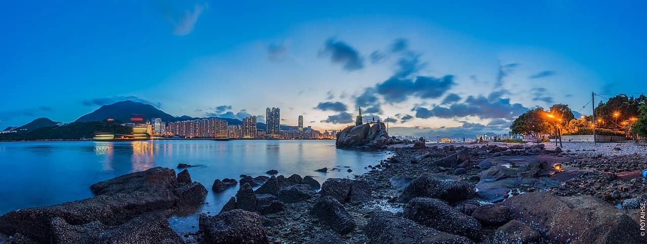
Kowloon's waterfront can be read like a history book. Along it are villages founded by stone workers, hills reshaped by quarrying, a residential scheme that became an airport, and former swimming and boating places buried beneath reclamation. Together they reveal how Hong Kong's access to the water has changed.
Kayarine has spent over five years running water activities in Sai Kung and introducing thousands of visitors to its coastline. This is a walking guide, not an invitation to enter the harbour. It explains why many coastal recreation trips now head beyond Kowloon, while managed city-based options also exist.
1. Walking areas compared
| Area | What to look for | Transport starting point | Walking difficulty |
|---|---|---|---|
| Sam Ka Tsuen, Lei Yue Mun | Stone-working villages, quarry remains and the channel | Yau Tong MTR | ⭐ Mainly level village routes; access varies |
| Cha Kwo Ling | Four Hills history and the changing quarry landscape | Check current connections from Lam Tin or Yau Tong | ⭐⭐ Slopes and changing access |
| Kwun Tong Promenade | Working typhoon shelter and landscaped waterfront | Kwun Tong MTR plus a walk | ⭐ Mostly level |
| Kai Tak waterfront | Former airport landscape and new development | Kai Tak MTR plus an appropriate onward connection | ⭐ Mostly level, but distances can be long |
| Lai Chi Kok Park | The landscape of a former bay | Mei Foo MTR | ⭐ Mostly level |
2. Lei Yue Mun: the harbour's eastern gateway
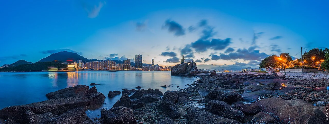
Lei Yue Mun separates Shau Kei Wan on Hong Kong Island from Yau Tong in eastern Kowloon. Its name appears in historical mapping, including Ming-period accounts of the Guangdong coast. The channel has long connected maritime movement, settlement and coastal defence.
Its rocky shores offer a striking contrast with the city's reclaimed waterfronts: look for surviving coastal landforms rather than assuming every section of the harbour has been reshaped in the same way. Claims that an entire shoreline has never been reclaimed require careful boundaries and historical evidence; visible rock alone is not proof of an unchanged coast.
The name and landscape
One explanation connects the name with the shape of a fish's mouth, with mun meaning a gateway or channel. Stories about carp swimming through or becoming dragons are local folklore, not established evidence for the place-name's origin.
⚠️ This is a working harbour entrance, not a casual paddling route. It has deep navigation water and frequent vessel movements, with currents and wakes that can endanger small craft. Enjoy the channel from established shore routes.
Sam Ka Tsuen and Ma Wan Tsuen
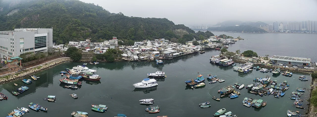
The Kowloon side around Devil's Peak and the nearby villages has a history of quarrying and maritime work. As quarrying declined, Lei Yue Mun became widely known for seafood dining. Ma Wan Tsuen, Sam Ka Tsuen and other settlements form part of this village landscape.
- Ma Wan Tsuen: The village is associated with stone workers and a Tin Hau temple. Alternative written forms of its name appear in local accounts, linking the settlement to the temple and hillside.
- Sam Ka Tsuen: Its name means three-family village, though accounts differ over which families it refers to. Settlers with links to the Meixian area of Guangdong worked in quarrying. Former quarry businesses used small piers to ship stone to other places.
- Pirate stories: Local accounts connect Lei Yue Mun with piracy along the southern China coast. Specific stories about named leaders and inherited bases should be treated as historical claims requiring evidence, rather than assumed facts about every visible ruin.
One especially revealing part of everyday history is the use of ferries and small rowing boats to reach Shau Kei Wan for trade and household supplies before road links improved. Boats were daily transport, not simply a leisure activity.
Across the channel on Hong Kong Island
The Shau Kei Wan side contains former coastal fortifications associated with Hong Kong's wartime history. The museum there is now the Hong Kong Museum of the War of Resistance and Coastal Defence, renamed in 2024. Former barracks also became Lei Yue Mun Park. These are separate visits across the harbour, not stops reached on foot from the Kowloon villages.
3. Cha Kwo Ling and the Four Hills
Cha Kwo Ling lies between Kwun Tong and Yau Tong. The place-name is commonly linked to the leaves of Macaranga tanarius, traditionally used when preparing cha kwo rice cakes. The village and hill have longstanding connections with quarrying and local administration.
How quarrying changed the landscape
An early twentieth-century military map identified the hill as Rocky Hill. Historical mapping recorded a substantially higher hill than the later quarried landscape, showing how extraction transformed its profile. Exact height comparisons depend on the map date and which part of the hill is measured.
Cha Kwo Ling, Ngau Tau Kok, Sai Tso Wan and Lei Yue Mun were known as the Four Hills of Kowloon, linked by granite quarrying and stone-working communities. Stone from this wider industry was used in construction in Hong Kong and beyond.
After the Second World War, fuel storage, clay extraction, workshops and nearby reclamation contributed to the area's industrial development. These layers help explain why former villages, transport infrastructure and modern housing sit close together.
The landscape continues to change through redevelopment. Check which public paths and heritage features are currently accessible rather than assuming every village street or structure described in an older guide remains open.
4. Kai Tak Bund: from housing proposal to airport
Kai Tak provides a particularly clear example of changing plans for reclaimed land.
In the early twentieth century, businessmen Ho Kai and Au Tak were associated with a land-reclamation company in Kowloon Bay. The original ambition was a garden-city residential development. The reclaimed area became known as Kai Tak Bund, taking its name from the two businessmen.
Economic and financial difficulties undermined the residential scheme. The land was later used for aviation, including flying clubs and training, and developed into Kai Tak Airport.
During the Japanese occupation in the Second World War, airport expansion affected nearby settlements and reshaped the area for military use. The airport's history is therefore also a history of displacement and wartime change.
Kai Tak today
After the airport moved, early redevelopment proposals included extensive reclamation. The plans were reconsidered, with a no-reclamation planning approach adopted in the subsequent review and public consultation.
The later Kai Tak development framework combined parks, housing, commerce, the cruise terminal and major sports facilities. Kai Tak Sports Park opened on 1 March 2025. The scale of the former airport site means you should plan walking distances and current access carefully.
5. Lai Chi Kok Bay: lost swimming and boating spaces
For anyone interested in water recreation, Lai Chi Kok is revealing. The park occupies part of the former bay landscape and adjoining land, developed in stages as the district changed.
In the 1980s, reclamation for community facilities changed the bay, and the former swimming sheds and boating area disappeared. Sports and park facilities subsequently became part of the new land-based neighbourhood.
Further West Kowloon reclamation in the 1990s extended the land south of Mei Foo. The park expanded, and its third phase includes Lingnan Garden, a Chinese garden inspired by the Lingnan tradition, which opened in 2000.
Kowloon did not simply lack places for water recreation: some existed and were later lost to reclamation. Today there are also managed urban water-sports options, so the history is not a claim that paddling is now impossible everywhere in Kowloon.
6. Suggested itineraries
- Half-day in East Kowloon: Start at Yau Tong and explore permitted village paths around Sam Ka Tsuen and Ma Wan Tsuen. View the channel from shore, then use current public transport and open routes toward Cha Kwo Ling or Kwun Tong Promenade. Do not assume an uninterrupted waterfront path connects every stop.
- Half-day around Kai Tak: Explore the sports-park surroundings or a selected Kai Tak waterfront section, then travel to Kwun Tong Promenade if time allows. The former runway is a long way from some MTR exits; choose your section rather than trying to cover everything on foot.
- An extra stop: From Mei Foo MTR, visit Lai Chi Kok Park and Lingnan Garden, and imagine the former bay beneath today's paths.
- What to bring: Water, a hat and comfortable shoes are useful. Some routes have slopes and limited shade. Check return transport and leave difficult or poorly lit sections before dark.
7. Waterfront safety
- Do not independently enter the harbour to swim: Harbour events and water activities have specific permissions and safety arrangements. For a managed city-based kayak or SUP session, look at Jockey Club Kai Tak Water Sports Centre and our Kowloon water activities guide.
- Wet seawalls and wave-break blocks are slippery: Do not cross barriers for photographs. A fall may leave you with no easy route back onto land.
- Old quarry structures: Do not climb or enter abandoned remains. Observe only from permitted public paths.
- Keep clear of working piers: Fishing boats and ferries need space for boarding, unloading and maneuvering.
- Villages are people's homes: Ask before photographing residents and respect private property, worship and daily work.
8. After the history walk, choose a suitable paddling experience
Kowloon's changing shore shows that access to water is not permanent. Sai Kung offers a different coastal landscape of bays and islands. In suitable conditions, a guided Sharp Island outing can combine kayaking and snorkeling in one day, without guaranteeing water clarity.
👉 Book the Sharp Island kayaking and snorkeling experience. Appropriately experienced paddlers can rent a kayak or SUP, or browse all water activities.
9. Frequently asked questions
Which places are the Four Hills of Kowloon?
Cha Kwo Ling, Ngau Tau Kok, Sai Tso Wan and Lei Yue Mun. Their stone-working communities were linked by granite quarrying, which supplied construction and reshaped the surrounding hills. Look for this history in official heritage interpretation and permitted surviving sites.
Where does the name Lei Yue Mun come from?
One explanation links the channel's shape to a fish's mouth, while mun refers to a gateway. Stories about carp turning into dragons are folklore, not proven etymology. The place-name appears in historical mapping of the coast.
Is Lei Yue Mun really the only unreclaimed part of Victoria Harbour?
The channel retains distinctive rocky coastal scenery, but the blanket claim that both shores have never been reclaimed depends on exact boundaries and historical evidence. It is more accurate to compare specific surviving landforms with documented reclaimed areas than to treat the whole shore as unchanged.
What was Kai Tak Bund, and how did it become an airport?
It was a reclaimed-land residential scheme associated with Ho Kai and Au Tak. The housing plans encountered financial difficulties, and the land later became used for aviation and eventually Kai Tak Airport. Today's redevelopment adds another chapter to that changing use.
Did Lai Chi Kok once have a boating area?
Yes. The former bay included swimming sheds and boating space that disappeared as reclamation and community development changed the shoreline. Later West Kowloon reclamation added more land south of Mei Foo, while the park expanded into today's landscape.